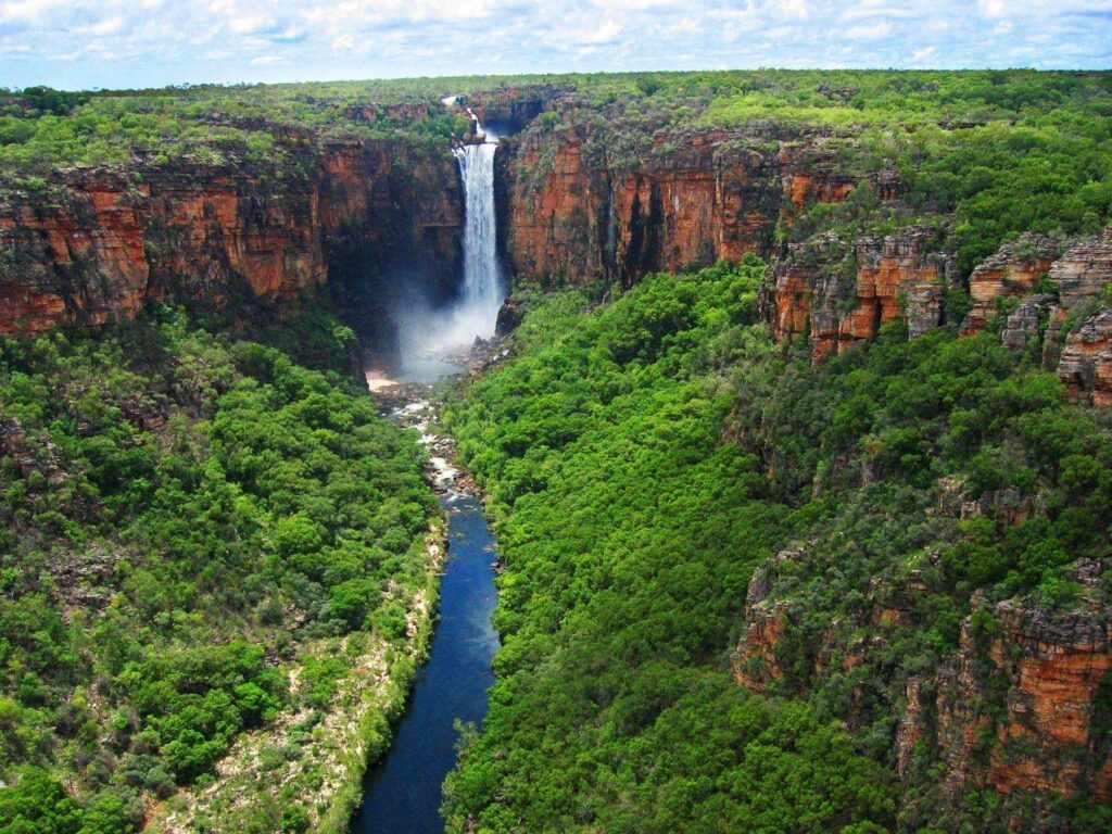
Fraser Island

Fraser Island

There’s a reason sine 400,000 people visit Fraser Island every year. Could it be for the island’s towering tropical rainforest which grow out of inhospitable sand? Or no less than a hundred freshwater lakes boasting crystal clear water? Perhaps it’s for the world-class beach fishing, or the 250 kilometres of sandy beaches? whatever your reason for coming to Fraser Island, you can’t go wrong with this spectacular UNESCO-listed outdoor playground. Named the “Great Sandy Peninsula” by Captain Cook in May 1770 _as he mistakenly thought it was connected to the mainland), we think its original named of K’gar or “Paradise” given to it by its original inhabitants some 5,500 to 20,000 years ago, the Butchulla people, is much more fitting. According to Aboriginal legend, the great god Beeral changed a beautiful spirit named K’gari into what is now known as Fraser Island, and gifted her birds, animals, people, trees, and flowers to keep her company. 

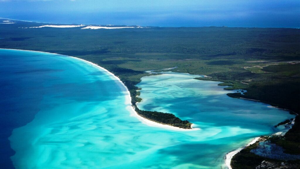
While legends may have faded, the reality is still very much a paradise. Some 123 kilometres in length and 22 kilometres across at its widest point, Fraser Island is considered the world’s largest sand island. Most of its 1,840 square kilometres as well as the marine zone around the island falls within the Great Sand Nation Park and Great Sand Marine Park, there by giving this pristine wilderness island a measure of protection. 

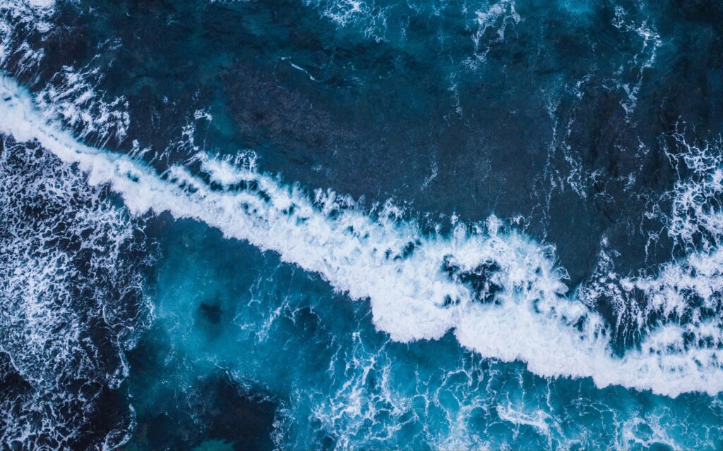
The island receieved further recognition when it was inscribed by UNESCO as a World Heritage Centre in 1992 for its ‘exceptional natural beauty” highlighted by long, sweeping streaches of wild ocean beach, vividly coloured sand cliffs, majestic old-growth rainforest rising from sandy dunes and a unique collection of rare fiora and fauna, including the famed Fraser island dingoes.

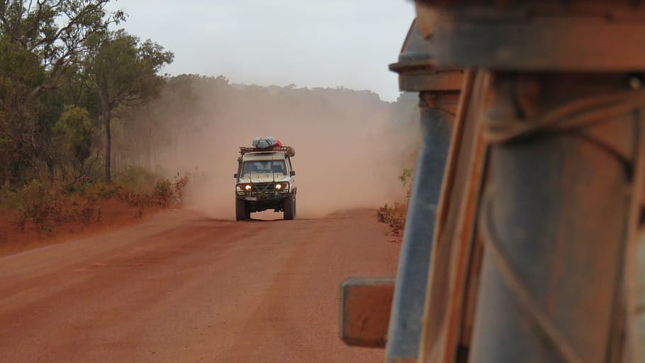
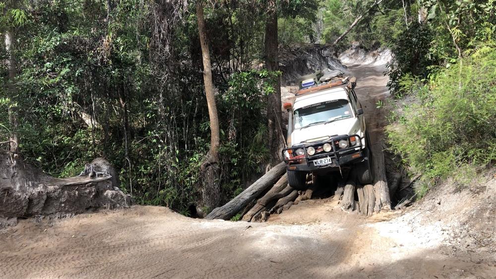
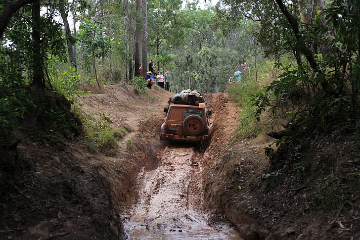
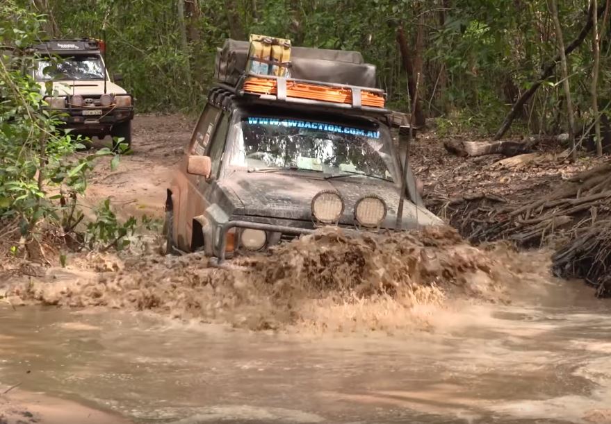
For 4WD enthusiasts, Fraser Island is truly a wilderness adventure. With no sealed roads, the island is strictly 4WD-only, adding a fun off-roading component to Nature’s sandy playground sculpted over hundreds of thousands of years by winds, waves and ocean currents.

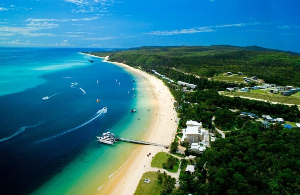
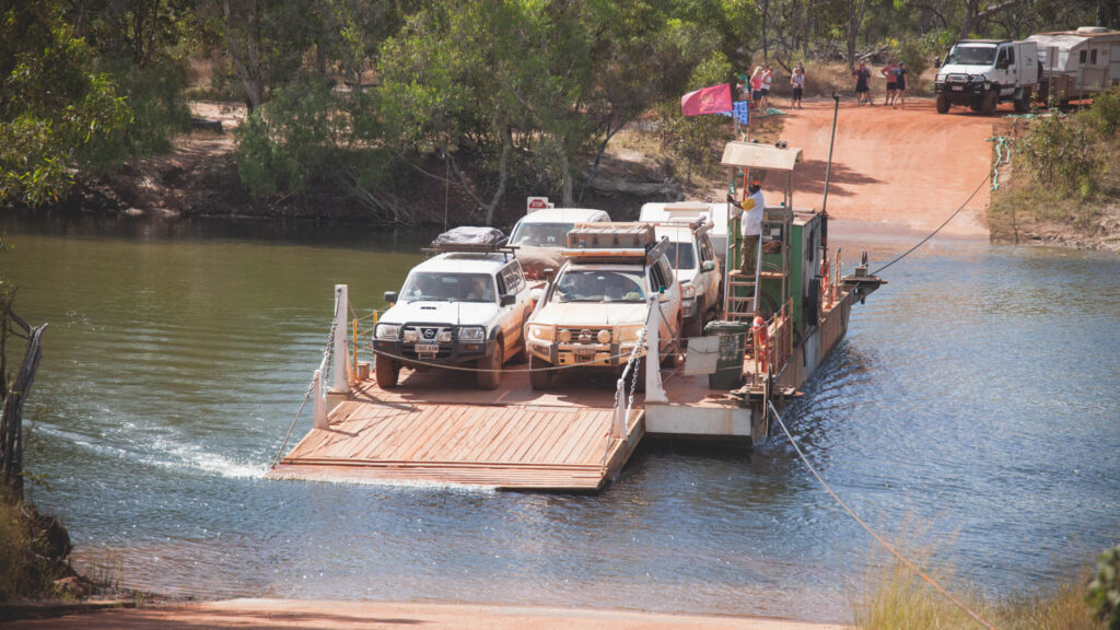
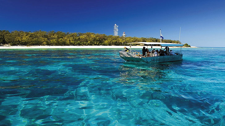
Steer your Fraser Island 4WD Hire Bush Camper towards Queensland’s Fraser Coast. about 300km north of Brisbane. Just south of the great Barrier Reef’s southernmost coral cays, Fraser Island is accessed by vehicular ferry from the mainland at Inskip Point towards the nothern end of Rainbow Beach (landing on the island’s southern tip) or from River Heads (30km south of Hervery Bay), arriving at Kingfisher Bay on Fraser Island’s west coast. Before you head off, enjoy views over the Great Sandy Strait or perhaps a gourmet meal at the posh Kingfisher Bay Resort

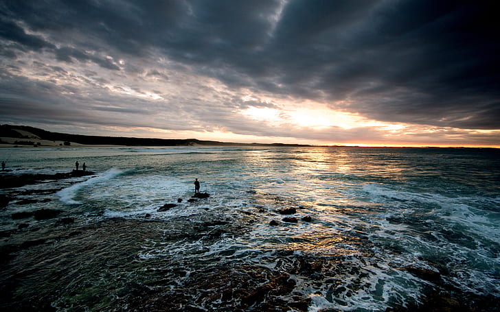
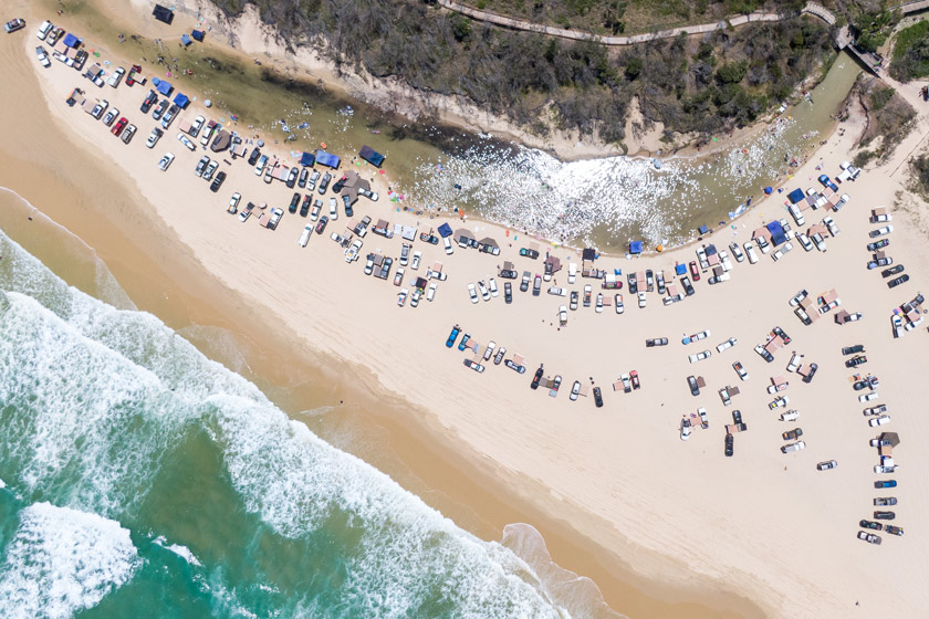
From there, jump on the island’s many thrilling 4WD tracks and explore the mind-blowing array of outdoor activities on offer. While there are no sealed roads on Fraser Island, the de facto “highway” is the famed Seventy-Five Mile Beach on the island’s east coast. However, be prepared to share this long strech of track with small aircraft which use the beach as a runway.

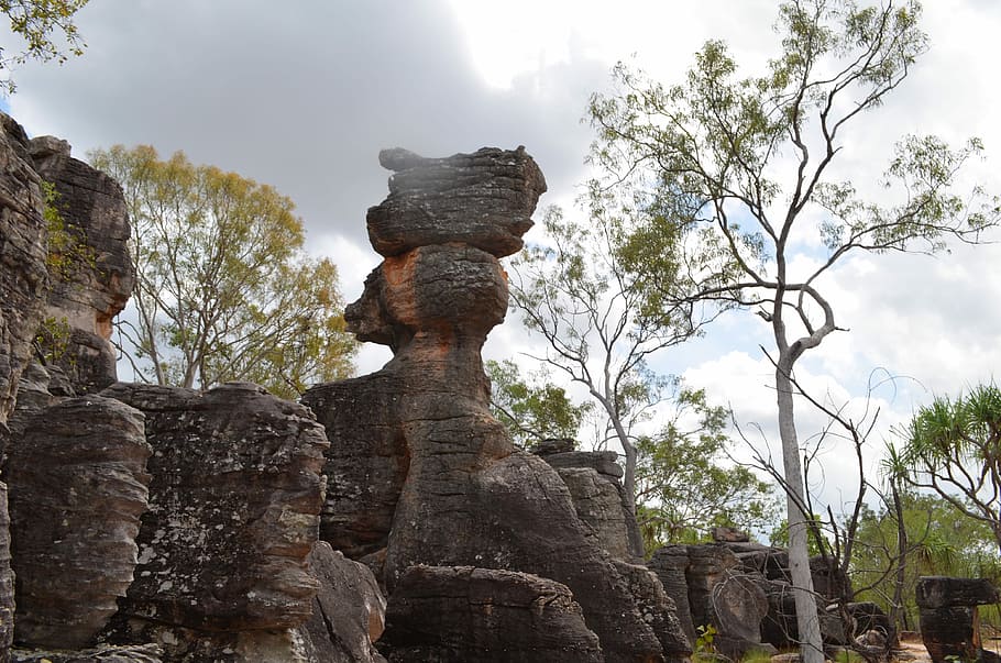
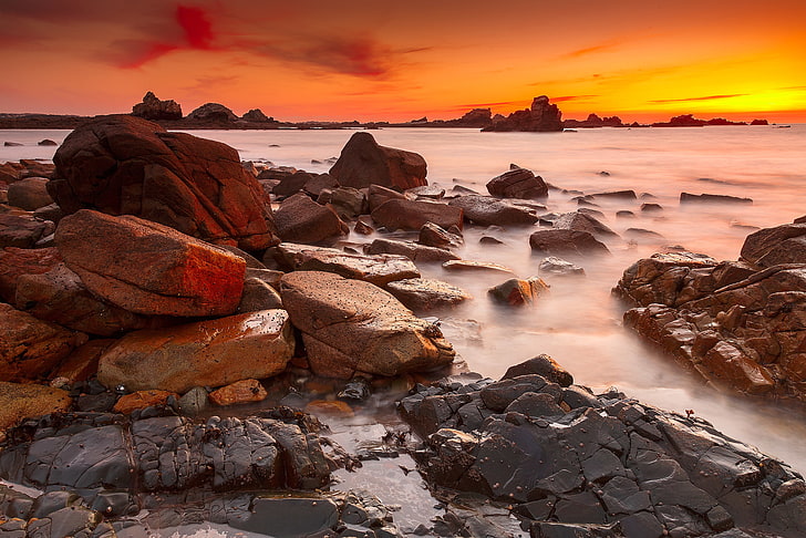
Get your bearing and head up the dune crest of Wungul Sandblow for awesome coastline views. While Seventy-Five Mile Beach is not swimming-friendly because of its strong current and large sharks, you’ll find some incredible sights along this sandy highway, including Rainbow Gorge, just south of Happy Valley, and the Pinnacles, raucously colorful cliffs made up of up to 72 different colours of sandy in mostly red and yellow hues. A spiritually significant site to the Butchella people, the Pinnacles are located about 20km south of Indian Head Lookout. If you stay for any length of time, you’ll see the colours change from reds to yellows to browns and oranges as the sun makes it way across the sky over this masterpiece of iron-rich clay and sand.

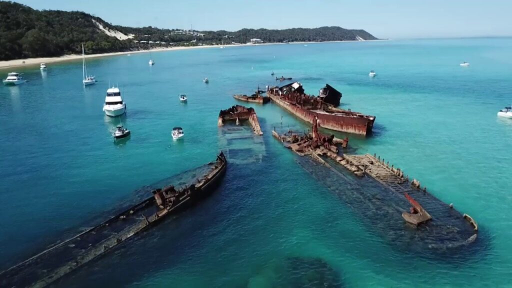
Along the Seventy-Five Mile Beach is the wreck of the SS Maheno. Originally a Scottish Ocean liner plying the waters of the Tasman Sea in the early 20th century, the ship was sold for scrap and on its way to a Japanese wrecking yard, when a cyclone grounded it onto the shores of Fraser Island in 1935, about 10km north of Happy Valley. Today, only a rusted skeleton remains, making for great photos against the crystalline blue waters of the Coral Sea. 

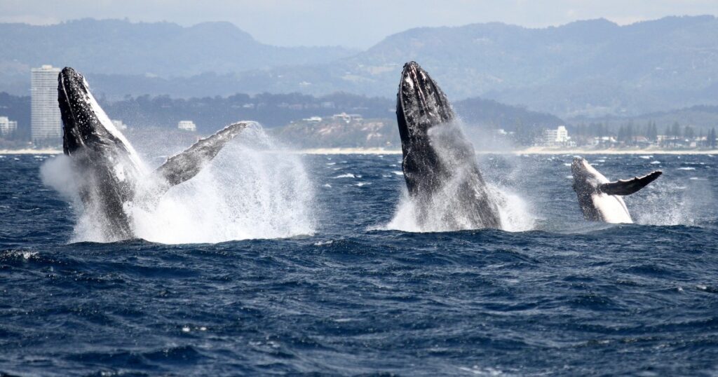
Seventy-Five Mile Beach is also home to some of the best beach fishing anywhere. Warmer months see whiting and bream while swallowtail, tuna mackerel and even sharks can be found year-round. From August to October, fishing enthsiasts gather for the Tailor Run, when huge schools of these aggressive fish make their way down the coast to breed. Other superb fishing spots on the island’s north and east coast include Sandy Cape, Waddy Point, Indian Head, and Middle Rocks. In addition to beach fishing, fly and reef fishing are also available on the island while mangrove jack and bream can be found in the island’s inland creeks.

All along Seventy-Five Mile Beach, you’ll find one Fraser Island’s most distinctive features – its mobile sand-blows. Continually formed and re-formed by the prevailing winds while being stabilised by grass and other coastal plants, Fraser island’s sand dunes are nevertheless actually moving across the island, covering and uncovering ancient forest on their way.

All this soft sand makes Fraser island a fun 4WD destination, either along Seventy-Five Mile Beach or heading inland on the Central Lakes scenic drive to take in the islands many stunning freshwater lakes.

In addition to Fraser Island’s ruggedly beautiful beaches, the interior of the island is home to more than 100 freshwater lakes, not to mention streams and tributaries, putting it just behind Tasmania for having Australia’a highest concentration of lakes, in fact, the ground beneath the sand dunes is thought to hold an astounding amount of rainwater, between 10 and 20 million mega litres!

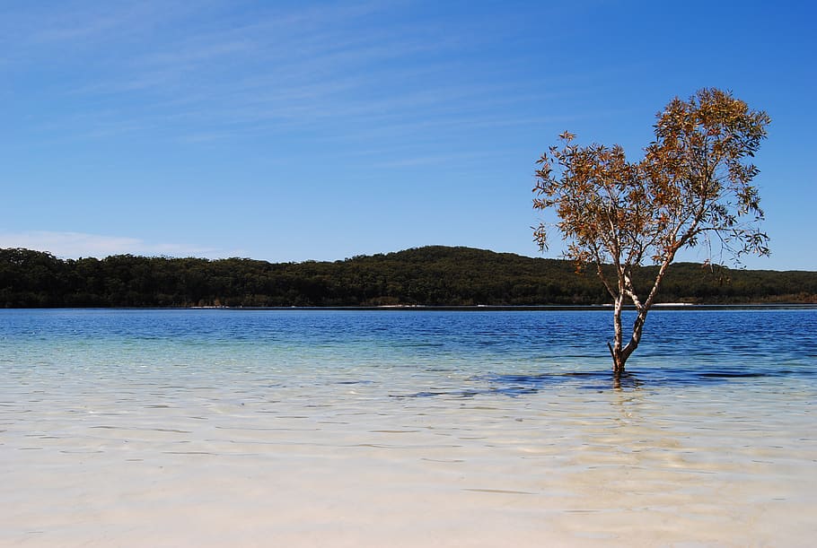
The island is home to some 40 perched dune lakes, half of the total number in the world, Perched lakes are formed when wind creates a depression in the land which is then covered in compacted sand and hardened organic matter like leaves and other vegetation. The lake then fills up with rainwater. While high acidity together with low nutrient levels means very few plants or animals inhabit the lakes, they make some of the cleanest lakes in the world with incredibly clear water, perfect for swimming! 

At 200 hectares, Lake Boomanjin is the largest perched lake in the world. The reddish water comes from the tanning of Tea Trees. While oddly-coloured, the shallow lake is great for relaxing and swimming, There are flush toilets and picnic areas around the lake for those who want to make. a day of it.

For more traditionally beautiful water, the island’s most popular perched lake has to be Lake McKenzie, often called the “Jewel of Fraser Island” for its amazingly clear, blue water surrounded by blindingly white silica sand, all enveloped by a forest of green trees, Easily accessible from either ferry drop-off, once you arrive at the car park, it’s just a short 100m walk along a jungle path and down some stairs to the lake, Facilities include hybrid toilets and a fenced picnic area with barecues. The lake is home to some turtles and fish, so feel free to bring a snorkel and mask along. Other popular perched lakes include isolated Lake Bowarrady, the black water Basin Lake, and Boomerang Lake, the world’s highest perched dune lake at 130m above sea level.

A second type of lake which Fraser Island is famous for Barrage lakes, formed when wind blows a sand dune into the path of a flowing creek or stream. One of the island’s favourite barrage lakes is Lake Wabby. At over 11m, it’s deepest dune lake on the island and its emerald waters are home to 12 species of fish. Come early to see the morning mist rising from the lake or hike up to the Lake Wabby Lookout for spectacular views. Either way, you’ll need to do some work to enjoy this secluded spot, as access is via two hiking trails, a shorter 1.5km hike from the Look Out Car Park, or a longer 2.4km hike closer to the town of Eurong.

For a slightly different swimming experience, head to Eli Creek, a large freshwater stream on the island’s east coast, not far from Happy Valley and the wreck of the SS Maheno. Walk along the wooden boardwalk, swim or float down the fast-flowing creek or somply soak in the atmostphere while enjoying a picnic lunch

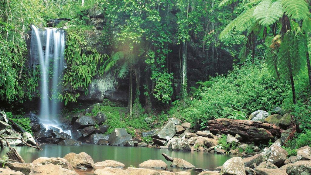
A range of walking trails to enjoy Fraser Island’s rain forest start from Central Station and the surrounding Pile Valley. Originally a logging camp, Central Station is the gateway to the area’s rain forests which grow from the sand, a remarkable feat considering that sand is notoriously nutrient-poor. Take some time to view the displays about the island’s development as well as its unique collection of plants and animals before striking out on one of the walking circuits through lush rain forests and along creeks. As you walk, notice how tall and straight the trees are, better to reach the sunlight through the thick canopy. Many visitors choose to make Central Station their base while on the island due to its large fenced campground area and availability of basic facilities

d

Bushwalking is another great way to appreciate the island’s natural beauty up close. While there are lots of shorter walks, the epic, 90km, six-day Fraser Island Great Walk takes in most of the island notable sites. For something slightly more manageable yet still challenging, the Lake McKenzie Circuit is about 20-24km round trip, exploring beaches, walking along boardwalks, and through scenic forests.

Campabout Oz 4WD Hire has a national wide network of agencies which are strategically positioned in close proximity to all famous tourism destination and hot spots, as well as major regional and capital cities throughout Australia so you are never far from a pick up point or friendly service to make your Road trip a memorable one. 


Campabout Oz 4WD Hire is renowned for meticulously maintained vehicles and quality service. Our fleet is constantly being updated to ensure you enjoy the best in comfort and safety making it the ideal choice for your next self-drive adventure. 4WD Tourism is one of the best ways to see the sights of Australia and it offers you the freedom & flexibility to discover the outdoors at your own pace. 
For your Gibb River Road 4WD Hire adventure please contact us on + 61 8 9858 9126 or email us on info@campaboutoz.com.au or visit us at www.campaboutoz.com.au


Moreton Island

Moreton Island

Moreton Island once had people hunted the waters around Morton Island at least 2,000 years ago, and the island is still home to more than 300 Aboriginal cultural sites. Captain James Cook first sailed the area in 1770, naming the bay where Morton Island is located after James Douglas, the Earl of Morton. A clerical error added an extra “e” and the bay and the island are now forever known as “Moreton”. Since then, the island has been home to a pilot station, whaling station and major wartime coastal defence bases, none currently in use. Still relatively untouched, Morton Island’s 192,600 hectares is up to 98% National Park, providing a true refuge for the island’s distinctive flora and fauna, both on land, sea, and air, as well as the diverse terrains on the island, including freshwater lakes, coastal sand dunes (some of the steepest in the world), and wetlands.

Morton Island can be accessed via three ferries. The Amity Trader plies the route between Stradbroke Island and the southern fishing village of Kooringal while the MICAT Ferry operates between the Port of Brisbane and the Tangalooma Wrecks on the island’s west coast. Those who have booked a day-cruise option at the Tangalooma Resort or who are staying overnight at the resort can take the pedestrian-only resort ferry leaving from the Holt Street Wharf in Pinkenba (Brisbane River Northsides). Built on the site of Queensland’s only whaling station between 1952-1962 and harvesting up to 600 migrating humpback whales per season, the Tangalooma Island Resort is now known for its
animal conservation efforts. Best known among these is the popular wild dolphin feeding programme.

Every sunset, visitors can watch from the jetty or wade into the water and hand-feed up to a dozen wild bottle-nose dolphins who come to the shallows in a ritual that started more than three decades ago. A Dolphin Care Team monitors the process, ensuring the dolphins are only fed a maxiumum of 20% of their daily food requirement so that they remain wild and independent Being in the water with these friendly, inquisitive mammals is a once-in-a-lifetime experience that is sure to delight young and old. The resort’s Eco Center also organizes feedings for kookaburras and pelicans as well as guided bush walks and educational talks about the old whaling station and local marine life.

On land, more than 40 reptile species call Morenton Island home, including bearded dragons and blue-tongued lizards, while the surrounding sea sees sharks, Green and Loggerhead turtles (which come ashore to next between November and February), more than 1,000 dugongs, and dolphins. Even more spectacular is the Humpback Whale migration from June to November when upwards of 15,000 whales make their way past Moreton Island.

Even if not staying at the Tangalooma Island Resort, the township itself is worth a visit. Climb up the dunes for sweeping views over the 8km-long Tangalooma Beach, home to the famed Tangalooma Wrecks, 15 vessels deliberately sunk in the 1960’s to form a man-made breakwall. The neat line of rusted brown hulls of old dredges and barges (with the tops ct off for safer swimming) rising from crystal-clear blue waters is certainly a striking sight. Bring your own snorkeling gear and swim out to enjoy the corals and tropical marine life around the wrecks or rent a transparent kayak (lit up at night) and glide over the water.

Home to massive wind-swept sand dunes, sit or lay down on a piece of waxed Masonite and hang on for dear life as you “sand toboggan” down the steep dunes at speeds of up to 60 kph! For something equially blood-pumping but a good deal slower, a hike up the sand dunes may be in order. Allot an hour and a half for the 4km-long desert circuit which takes you along the beach and up to the sand boarding hill with opportunities to spot desert wildlife.


To see the majority of the island’s highlights, you’ll need to hug the coast north from Tangalooma. A 25-minute drive will take you to the village of Cowan, once home to a pilot station and military camps. Nowadays, it’s best known for the Curtin Artificial Reef comprised of 32 ships and other man-made structures sunk here since the late 1960’s. This submerged marine playround is popular among drivers for both the wreck and the plentiful ocean life including turtles, sharks, stingrays and giant grouper at depths from 12 to 28 meters.

The Western Coastline, you’hit the charming fishing village of Bulwer, with its 8km-long beach boasting calm, clear seas and great sunset views over moreton Bay. Bulwer is also ideal for swimming and Bulwer Wrecks (three ships scuttled in the 1930s in shallow 1-2m-deep water) and the Car Bodies (a sunken old and VW Beetle) at the south end of town. If you continue north you’ll pass the dynamic beaches of Health Island and Yellow Patch. There’s even surfing to be had at North point and Boulders Beach. At the northern tip of Moreton island, you’ll also find the Champagne Pools, created as waves roll over a natural break wall of volcanic rock and sandstone. Wade into the sandy pools and allow the frothy water to pour over you like a glass of bubly, making for great photos!

Just around the corner, you’ll a series of four small beaches created by a ridge of bedrock. Make your way through the rocks to the best known and most accessible, Honeymoon Bay, dramatically backed by rocky cliffs. While beautiful to look at, look out for rips and big waves. This part of the island is also known for superb diving around the only true coral reef, Flinders Reef, a gorgeous collection of hard and soft coral along with teeming marine life including turtles, rays and woobegong sharks. Divers may also be lucky enough to hear a hauntingly beautiful whale song or two during migration season.

Another must-see attraction around Cape Moreton is the historic 23m-high lighthouse, Queensland’s very first. Built in 1857 by tradesmen and convicts to guide ships navigating the treacherou entrance to Moreton Bay on their way to Brisbane, the fully-functioning, fully-automatic red-striped lighthouse now provides a superb vantage point from which to spot dolphins, whales, sharks, and dugongs. Don’t miss the excellent museum inside the old caretaker’s cottage for insight into the history of the lighthouse and Moreton island. Rounding the cape and coming back down on the island’s eastern coast, you’ll hit a pair of freshwater lakes, both excellent for a refreshing swim. The trea tree oil-infused Blue lagoon is the larger and more popular of the two with its surrounding wild flowers and birdwatching opportunities, whereas Honeyeater Lake is home to a large variety of birds (including the lake’s namesake honeyeater which comes to feast on the flower spikes and fruiting cones of the banksia flower).

At this point, fitness enthusiasts might want to leave your 4wd behind and undertake the 6-hour, 16km-long return hike along the old telegraph Road track that leads from the Bulwer – Blue Lagoon Road on down to Mount Tempest. Add in another 2 hours to make the difficult hike up what is quite possibly the world’s highest coastal sand dune and be rewarded with uninterrupted views in every direction from 285 meters above sea level, sweeping across the Sunshine Coast on down to Brisbane and the Gold Coast on a clear day.

Campabout Oz 4WD Hire has a national wide network of agencies which are strategically positioned in close proximity to all famous tourism destination and hot spots, as well as major regional and capital cities throughout Australia so you are never far from a pick up point or friendly service to make your Road trip a memorable one. 


Campabout Oz 4WD Hire is renowned for meticulously maintained vehicles and quality service. Our fleet is constantly being updated to ensure you enjoy the best in comfort and safety making it the ideal choice for your next self-drive adventure. 4WD Tourism is one of the best ways to see the sights of Australia and it offers you the freedom & flexibility to discover the outdoors at your own pace. 
For your Gibb River Road 4WD Hire adventure please contact us on + 61 8 9858 9126 or email us on info@campaboutoz.com.au or visit us at www.campaboutoz.com.au

Savannah Way

Savannah Way

The Epic Savannah Way stretches from coast to coast from Broome in the
North West of Western Australia to Cairns in North Eastern Queensland
through the heart of the outback. The Savannah Way is a 3700 kilometre
trek across the top end of Australia and is an excellent length for a 14 day or
90 day adventure across Northern Australia. The route is designed to also
accommodate shorter trips with linkages to many other themed routes like
Matilda, Overlander’s and Explorer’s Highways and has the potential for fly
and drive options.

Savannah Way offers “last frontier” style of tourism with the main attractions and characteristics like: Outback Experiences, dirt and bitumen roads, small towns, camping and caravan accommodation, open spaces Natural Attractions, gorges, waterholes, lakes, rugged landscape, birds, native animals, star gazing Heritage and Culture, Indigenous & European, mining, agriculture, exploration, tourism Adventure, Ultimate camping, outdoors, fishing, hunting, and 4WD fun It’s a journey that will be your lasting memory, so take your time and experience the raw natural beauty of Australia’s top end. Navigate your way across the Top End on this ultimate adventure journey from Cairns on the east coast to the white sands and blue water of Broome in the far north-west. Experience stunning landscapes carved by nature over millions of years and traditional Aboriginal communities and artworks.

Cairns to Undara

Take from Cairns going to Undara via Atherton Tablelands. The Undara Volcanic National Park is one of Australia’s greatest geological wonders, boasting the best preserved and largest lava tubes system on earth. A Savannah Guide Station, Undara Experience, offers a variety of touring options.

Undara Volcanic National Park

The Undara system of volcanoes has some 164 craters. Around 190,000 years ago, the main Undara crater, the highest and most dominant vent, produced a geological phenomenon that is rare and fascinating – The Undara Lava Tubes. The tubes wind through old riverbeds for a distance of 160 km and can be accessed through the Savannah Guide Outstation at the Undara Experience.

Undara to Forsayth – (Cobbold Gorge)

Cobbold Gorge, 55 minutes from Forsayth, is located on a privately owned family cattle property and can only be accessed on a guided tour. Visitors are taken through the narrow, meandering gorge on electrically driven boats. Sheer cliffs, perhaps a crocodile, birds and fish all add to a geological experience created by earthquakes.

Forsayth to Normanton

Around 30km to the south-west of Normanton is Camp 119, Burke and Wills’ most northerly camp. The wetlands between Normanton and nearby Karumba are also excellent for bird watching, particularly just after the summer `wet season.’

Normanton to Hells Gate

The Savannah Way from Normanton to Borroloola is unsealed and suitable only for 4WD vehicles. Just 50 km’s inside the Queensland border, Hell’s Gate Roadhouse is the gateway to the Macassan coast and provides accommodation and a campground. Savannah Way 4WD Hire recommends side-trip from Burketown to Lawn Hill National Park via the township of Gregory as well as the spectacular scenery and wildlife Lawn Hill also has two areas open to view Aboriginal Art. The gorge has a prolific selection of Aboriginal artifacts and tool factories, which can be viewed, but are definitely not to be collected. Adel’s Grove, located adjacent to Lawn Hill National Park features a campground, shop, restaurant and service station.

Hells Gate to Borroloola

Borroloola is a remote fishing community beside the McArthur River in the gulf region of the Northern Territory. It is famed for unique history, characters and excellent fishing. Many visitors use Borroloola as a base for barramundi fishing expeditions. The town is an ideal location to stock up before exploring the gulf region.

Borroloola to Katherine via Roper Bar

On the way to Katherine, make time to visit the small community of Roper Bar, situated on the tidal pandanus-fringed Roper River. About 25km downstream is the wreck of the Young Australian which was used for towing large sailing vessels carrying supplies for the Overland Telegraph Line in 1872. Katherine is a bustling trade town in the heart of the top end. Home to over 10,000 people, highlights include the Springvale Homestead, NT Rare Rocks, the Katherine Museum, Katherine School of the Air and Katherine Springs.

Katherine

Take a day’s rest from driving and visit nearby Katherine Gorge, one of the Territory’s most scenic natural attractions. There are 13 gorges in the system carved out of ochre sandstone and separated by rapids. The Gorge can be explored by cruise boats, canoes, fixed wing and helicopter flights, bushwalking and swimming. Walk for 66km along the Jatbula trail to Edith Falls, cruise the Gorges on a 2,5 or 6 hour cruise, or just have lunch at the Nitmiluk Visitor Centre. You can finish your top end exploration today by driving north from Katherine to Darwin (316 kilometers, approximately 4 hours’ drive).

Katherine to Timber Creek (Gregory National Park)

Located on the doorstep of Gregory National Park, the township of Timber Creek is a major stopping point between Katherine and Kununurra on the Western Australian border. Local fish are Timber Creek’s biggest draw card and the magnificent Gregory National Park is its backyard. Covering an area of approximately 13,000 square kilometers, Gregory’s awesome landscape is composed of red rimmed escarpment ranges, plunging gorges and intriguing boab trees.

Timber Creek to Kununurra

Kununurra is the eastern gateway to Western Australia’s top end. Nearby Lake Argyle is a massive inland sea that spreads out over an area of 1,000 square kilometers and contains 12 times the water volume of Sydney Harbor.

Kununurra to Turkey Creek (Purnululu National Park)

Purnululu National Park, in the East Kimberley Region of Western Australia, was inscribed on the World Heritage List in 2003, for its outstanding universal natural heritage values. Twenty million years of weathering has produced the eroded sandstone towers and banded beehive structures of the Bungle Bungle Range, the geographic highlight of this National Park. There are camping facilities at Walardi or Kurrajong Camp with both sites having toilets and water. Petrol and supplies are available at nearby Turkey Creek.

Purnululu (Bungle Bungles) National Park

Spend the day exploring Purnululu National Park. For a breath-taking view of the Bungle Bungles take a scenic flight – available from nearby Hall’s Creek.

Fitzroy Crossing to Broome

Broome was once the pearling capital of the world and drew its population from a range of nations whose people came on the promise of pearls and in the hope of making a fortune. Its colorful history has resulted in a multi-cultural feel. Broome is famous for Cable Beach – all 22 kilometers of it. This is undoubtedly one of the world’s most stunning beaches – a white band of sand bordering a brilliant blue ocean.

Turkey Creek to Fitzroy Crossing

Follow the Great North Highway west to Fitzroy Crossing. The town is approximately 114 meters above sea level and is surrounded by vast flood plains of the Fitzroy River. The magnificent Geikie Gorge National Park is 18 kilometers from the town on a sealed road.

National Parks and Camping Sites

National Parks have serviced camp areas, many with onsite rangers, designated powered and unpowered sites, fresh water, toilets and shower facilities. These areas may have restrictions on length of stay and park fees may apply. See the Department of National Parks, Recreation, Sport and Racing website for more information about national park camping sites and fees. There can be huge distances between townships so you may have to camp on private properties or Aboriginal Lands, make sure you obtain permission and permits before entering the area. Some roads are not suitable for towing a caravan and there are camping restrictions in certain areas. Please check road conditions and permit requirements with the local Parks Management before you set off on your journey.

For more travel advice, visit DMR.qld.gov.au

Campabout Oz Camper Hire

Campabout Oz 4WD Hire has a national wide network of agencies which are strategically positioned in close proximity to all famous tourism destination and hot spots, as well as major regional and capital cities throughout Australia so you are never far from a pick up point or friendly service to make your Road trip a memorable one. 


Campabout Oz 4WD Hire is renowned for meticulously maintained vehicles and quality service. Our fleet is constantly being updated to ensure you enjoy the best in comfort and safety making it the ideal choice for your next self-drive adventure. 4WD Tourism is one of the best ways to see the sights of Australia and it offers you the freedom & flexibility to discover the outdoors at your own pace. 
For your Gibb River Road 4WD Hire adventure please contact us on + 61 8 9858 9126 or email us on info@campaboutoz.com.au or visit us at www.campaboutoz.com.au

Litchfield National Park

Litchfield National Park

It’s a journey that will be your lasting memory, so take your time and experience the raw natural beauty of Litchfield National Park. Hit the road out of Darwin to discover the region’s stunning national parks, pristine river systems and abundance of nature and wildlife. Experience stunning landscapes carved by nature over millions of years and traditional Aboriginal communities and artworks. Litchfield National Park is just an hour-and-a-half drive from Darwin and features a myriad of diverse environments including rugged sandstone escarpments, perennial spring-fed streams, monsoon rainforest, magnetic termite mounds, waterfalls and historic ruins. This 1,500 square kilometer park was the original home of the Wagait Aboriginal people. The Finniss exploration was the first European connection to the area and the Park was named after Frederick Henry Litchfield, a member of the expedition. For 75 years until 1955, the area was the center for tin and copper mining. It then fell under a pastoral lease until it was designated a national park in 1986.

You can spend as little as 2 days in the park, taking a quick dip in each of the plunge pools and rock holes on the drive through, but to really experience the true beauty of Litchfield it’s best to stay at least 3-4 days. Litchfield National Park’s major attractions are linked by a sealed road, although a four- wheel drive is necessary to access some of the more remote natural attractions. It is also possible during the dry season to travel by four-wheel drive down the Southern Access Track to the Daly River Road.

The crystal-clear swimming holes and pleasant bushwalking trails make this park a favorite among Darwin locals. Meals and refreshments are available near Wangi Falls at Litchfield Cafe, and you can stay overnight at a number of campgrounds in the park or in the small township of Batchelor – the gateway to Litchfield.


Litchfield National Park Recommendations

Jump in a 4WD and discover the dramatic splendor of Tjaynera (Sandy Creek) Falls, Blythe Homestead Ruins and the weathered sandstone columns of the Lost City. Hundreds of two meters high magnetic termite mounds reveal the architectural feats of these intriguing insects that build their mounds aligned north and south to minimize exposure to the sun and maximize temperature control. View the spectacular double waterfall of Florence Falls set amid the monsoon forest – 160 steps lead down to the plunge pool. Cool off at Buley Rockhole, a series of cascading waterfalls and rock holes located just 80 meters from the car park. Visit Wangi Falls, one of the park’s best swimming and picnicking spots.

More Sweet Spots;

The spectacular Florence Falls cascade into a plunge pool, set in a pocket of monsoon forest. Take a refreshing dip in the plunge pool and then enjoy a scenic walk to the viewing platform high above the falls, which affords panoramic views of the open valley and the waterhole below. Open year round. Camping fees apply.

Buley Rockhole is a series of waterfalls and Rockhole’s, where you will find your own spot to swim and relax. Open all year round, camping is available with toilet facilities only and camping fees do apply.

Wangi Falls is Litchfield’s most popular and easily accessible attraction with a cafe and art center. An interpretive walk to the top of the falls commences near the pool and offers a great opportunity for photography. Wangi has a campground with all amenities including toilet, shower, kiosk and barbecue facilities. Open all year round. Swimming not always possible due to water levels. Camping fees apply.

Nestled in an open valley, luxuriant with paperbarks, the Falls can be found by walking along a 1.7 kilometer trail. Relax and enjoy the usually uncrowded plunge pool. Nine kilometers from the Southern Access Track. Open May to November and 4WD accessible only. Camping fees apply.

Surprise Creek Falls is a place to relax and enjoy a swim in an uncrowded waterfall. Camping facilities are available. 4WD access only.

Tolmer Falls cascades over high escarpments into a deep plunge pool. With a viewing platform at the top, access to the bottom of the falls has been restricted to protect the habitat of colonies of ghost bats and orange horseshoe bats. Open all year round.

The Greenant Creek Walk through rainforest leads to another attractive plunge pool which is typically uncrowded. The walk is approximately 2.7 kilometers return, of moderate level and can usually be completed in one and a half hours. Start at the bridge across Greenant Creek.

Bamboo Creek and Walker Creek

Until the early 1950s, the Park was home to several tin and copper mines and relics of this mining era can be seen at Bamboo Creek Tin Mine. What remains of the site is still in good condition. From Bamboo Creek car park it is a one kilometer walk to view the sites. Commencing from the car park, the Walker Creek Walk is a moderate level walk of approximately 3.5 kilometers return and of two hours duration.

Blyth Homestead

The historic Blyth Homestead located at the site of an old tin mine, now in ruins, serves as a reminder of the tough conditions faced by pioneers in remote areas. The Homestead has been untouched since it was abandoned in the early 1960s. Open daily. Access is by 4WD only off Sandy Creek Road, check road conditions in the tropical summer.

Magnetic Termite Mounds

One of Litchfield National Park’s most unique sights is the hundreds of termite mounds standing up to two meters high. The mounds’ thin edges point north-south minimizing their exposure to the sun, keeping the mounds cool for the termites inside. An information shelter provides a fascinating insight into these remarkable creatures and their habitat.

The Lost City

These impressive freestanding sandstone blocks and pillar formations bring to mind the ruins of a long-forgotten civilization. 4WD access only, check road conditions.

The Table Top Track

This excellent, long distance bushwalk offers the opportunity to experience the isolation of the Top End. You’ll hike through extensive woodlands, along creek lines to scenic waterfalls and pools. The 39 kilometer circuit is suitable for experienced, fit and well prepared bushwalkers willing to carry their own supplies, water, and camp with minimal facilities. Link walks connect to the Tabletop Track at Florence Falls, Greenant Creek, Wangi Falls and Walker Creek. These link walks may be used to take shorter walks on sections of the main Tabletop Track. The track is normally closed between September and March for the wet season. To access the track at this time a permit must be obtained. At other times the threat of bushfires may necessitate closure of the track. If you are planning an extended walk involving overnight camping, you must obtain a permit prior to your trip and camp only in the three designated camping spots provided along the Tabletop Track. Permits can be obtained from the Parks and Wildlife Office in Batchelor. Overnight walkers are strongly urged to register with the Overnight Walker Registration Scheme by calling 1300 650 730 Day walkers should advise someone of their intended route and expected return time. It is also recommended that your group carries a detailed topographic map of the area ‘Australia’s Northern Territory Litchfield National Park’. Copies are available from the Batchelor General Store.

Accommodation

For campers there are ultimate experiences for camping located all over the National Park. Camping fees apply so keep an eye out for the ‘Park Fees’ brochure, which is also available from Tourism Top End. Concessionaires manage most campgrounds within the park.

  • Banyan Tree Caravan Park

  • Batchelor Butterfly Farm & Tea House

  • Batchelor Resort

  • Litchfield Tourist Park

  • Litchfield Safari Camp

  • Rum Jungle Bungalows

  • Pandanus on Litchfield

National Park and Camping Sites

National Parks have serviced camp areas, many with onsite rangers, designated generator and non-generator sites, fresh water, toilets and shower facilities. These areas may have restrictions on length of stay and park fees may apply. See the Parks and Wildlife Commission NT website for more information about national park camping sites and fees. There can be huge distances between townships so you may have to camp on private properties or Aboriginal lands, make sure you obtain permission and permits before entering the area. Some roads are not suitable for towing a caravan and there are camping restrictions in certain areas. Please check road conditions and permit requirements with the local Park Management before you set off on your journey.

For more travel advice, visit http://www.parksandwildlife.nt.gov.au/parks/access

Kununurra

Kununurra

Embrace adventure in a world of vast lakes, ancient ridges and ranges, rare pink diamonds and huge stations. It’s easy to see why the place was called Kununurra – it means ‘big water’ in the language of Aboriginal tribes who have roamed this landscape for thousands of years. There’s something about wild, remote Kununurra that fires the spirit of adventure in even the most timid of travelers. It could be the blue skies, scorching red soil and rugged bush scenery, or the fact it is the gateway to the East Kimberley and some of Western Australia’s remarkable natural attractions. From here you can visit World Heritage-listed Purnululu National Park and the beehive-shaped towers of the Bungle Bungle range, thought to be 350 million years old. Or see their miniature versions in amongst the amphitheaters, gullies and ridges of Mirima National Park. You can take a helicopter over the mighty OrdRiver and man-made Lake Argyle, which is large enough to be classified as an inland sea. Trek Mitchell Plateau and see the majestic Mitchell Falls – a series of four waterfalls – cascade over layers of rock into a deep pool.

The Kimberley’s

The Kimberley’s in Australia is one of the last true wilderness areas on Earth, with iconic outback landscapes and undiscovered secrets billions of years in the making. Covering nearly 423,000 square kilometres in north WA, with a population of less than 40,000 people, it’s here you’ll encounter some of the most extraordinary outback adventures in Australia. Discover ancient gorge country, vast cattle stations, pristine castaway beaches, one of the oldest surviving cultures on Earth and the world’s only horizontal waterfalls.

Gibb River Road

The legendary Gibb River Road Top Trail is an icon of outback adventure through the heart of the Kimberley in Western Australia’s North West. The moderate 660 kilometre dirt track passes through remote station country with magnificent scenery and plenty of opportunities to get out of your vehicle to discover one of the many fresh water gorges. See freshwater crocodiles in the Windjana Gorge National Park and swim, bushwalk and camp at Lennard and Bell Gorges. Take a scenic flight over Mitchell Falls and the vast Mitchell Plateau. Stay on the one million acre El Questro Wilderness Park. From here you can go horse trekking, get up close to Kimberley wildlife and boat down Chamberlain Gorge past towering escarpments and Wandjina rock art. You could even take in the sights on a mountain bike for the Brisbane to Broome Charity Bike Ride. However you take on this outback challenge, remember it’s one that needs planning.

The Gibb River Road leads you through a land of sweeping plains and rugged ranges. It’s the very land our national anthem sings off. The Kimberley rock formations & ranges change colour right before your eyes as the sun slowly shifts on its journey west. Along its entire length, deep creviced gorges provide picture postcard vistas as seasonal rains cascade down waterfalls to the cool crystal clear rock pools that settle below. The Kimberley is full of spectacular & picturesque gorges, waterfalls, rivers, ranges, rock pools, wildlife and people to experience and enjoy with each location as unique and as memorable as the last.

The Savannah Way

Two of Australia’s greatest 4WD Hire Adventures can be found here: The Savannah Way between Broome and Darwin via Kununurra and the 660 kilometre Gibb River Road. Derby, east of Broome, is the base for exploring the Buccaneer Archipelago – a thousand or so islands scattered across the Timor Sea.

Fitzroy Crossing and Halls Creek

Set on the banks of the mighty Fitzroy River, 391 kilometres east of Broome, Fitzroy Crossing in Western Australia (WA) is a true outback town. Drive out to the original town site and visit the legendary Crossing Inn, built in 1897 as a shanty inn and trade store for long-distance travellers. Today, Fitzroy Crossing in WA is a great base to explore Tunnel Creek National Park and Windjana Gorge National Park. It’s also the gateway to the Geikie Gorge National Park, a spectacular waterway with soaring weathered cliffs and abundant wildlife. Indigenous tours also offer an excellent insight to local Indigenous history and culture, including bush tucker and medicine.


El Questro Homestead

Located in the east of the Kimberley and extending for approximately 80 kilometres north-south and 60km east-west, the station totals just under 1,000,000 acres in size. El Questro Homestead is an exclusive luxe retreat for maximum 18 guests, perched on a cliff top overlooking the Chamberlain River and Gorge. The El Questro Wilderness Park in Western Australia’s remote East Kimberley region brings to life an ancient land with an extraordinary diversity of landscapes. Here rugged sandstone ranges and deep weathered gorges surrender to pockets of rainforest and picturesque waterfalls. Covering one million acres, the El Questro Wilderness Park is five times the size of the island of Tasmania and around the size of a small European country. Around the fresh water springs and lazy salt-water estuaries in the northern part of the property, an abundance of Australian animals, fish and bird life gather. Take a private cruise or swim in the clear fresh waters. Soak in hot springs, or trek on horse- back and see the countryside from a new vantage point.

Ord Valley Muster

This May, head to Kununurra for the Ord Valley Muster, a vibrant two-week celebration of East Kimberley life. You’ll join thousands of friendly locals at more than 50 events across the region’s rugged and magical landscapes. Dress up for a 4WD adventure bash, swim across Lake Argyle or mountain bike along the Gibb River Road. Taste fresh Kimberley produce and enjoy Aboriginal music and dance. Get swept away in a street party, dig for diamonds or watch rough-riders at a rodeo. Not-to-be-missed is the Kimberley Moon – the flagship music concert on the banks of the Ord River. It’s a three hour flight north from Perth to Kununurra, the gateway to the wild, sweeping landscapes of the Kimberley. The region is most famous for its striking natural attractions such as the beehive-shaped towers of the Bungle Bungle range, vast Lake Argyle, the Ord River and cascading waterfalls of the Mitchell Plateau. Harder to portray on a postcard is the warmth, hospitality and maverick attitude of the locals – traits you’ll fully appreciate during the Ord Valley Muster.

Bungle Bungle Range

Nestled in the far north-west of Western Australia, the Bungle Bungle range in the World Heritage-listed Purnululu National Park is one of Australia’s best-kept secrets. For more than 350 million years, nature’s forces have shaped these mysterious geological features in this prehistoric landscape. Apart from the local Kija Aboriginal community, few people knew they existed until the 1980s. The giant orange and black striped domes rise out of the ground creating a bewildering landscape unlike anything you have ever seen. One of the best ways to appreciate the scale of this natural wonder is on a scenic flight. As you sweep over the range, the intricate maze of tiger-striped domes reveal a hidden world of narrow, sheer-sided gorges lined with majestic palms and seasonal waterfalls and calm pools. According to Aboriginal Dreamtime legends, the amazing beehive-like domes that form the Bungle Ranges were created by the Rainbow Serpent as she slithered across the landscape. Aboriginal people have used the area for their sacred rituals for around 20 000 years.

Lake Argyle

Cruise or fish the expansive, wildlife-rich waters of Lake Argyle, near Kununurra, the biggest man made lake in the southern hemisphere. Created by the Ord River Dam, it’s classified as an inland sea and at its peak in the green season Lake Argyle holds a staggering 32 million cubic metres of water. That’s more than 20 times the size of Sydney Harbour.

4WD Travel, Adventure and Camping

The wide open wilderness areas and warm climate of the Kimberley region make them ideal destinations for caravan and camping holidays. Major town centres have a range of caravan parks and camping grounds. The main season is between May and September, so you need to book in advance to avoid disappointment. Start planning your holiday with Kununurra 4WD Hire and search forcaravan parks and camping grounds. Best travelled after the wet season rains have gone it is generally April/May when they reopen “the Gibb” to vehicles. A good deal of the wet season rains still flow early in the season so those out early will experience creek crossovers on the drive and waterfalls that make for spectacular reward at the end of each short walk. The Gibb River Road closes when seasonal rains commence in December/January. Always check current road conditions and warnings before you start your journey. Click here to see today’s Main Roads Kimberley. The first thing you need to plan for your road trip is a vehicle. A 4WD is highly recommended. If you are taking your own vehicle, make absolutely sure it is road worthy. Remember you have already driven your vehicle a long way to get here and if you break down on “The Gibb” parts are not readily available and towing is bloody expensive. If you want to hire a camper trailer, camping equipment, baby seats or cots, satellite phone, extra spare tyre, jerry can or anything else needed for your journey click on links Broome, Derby or Kununurra.

National Park Camping Sites

National Parks have serviced camp areas, many with onsite rangers, designated generator and non-generator sites, fresh water, toilets and shower facilities. These areas may have restrictions on length of stay and park fees may apply. See the Department of Parks and Wildlife website for more information about national park camping sites and fees. There can be huge distances between townships so
you may have to camp on private properties or Aboriginal lands, make sure you obtain permission and permits before entering the area. Some roads are not suitable for towing a caravan and there are camping restrictions in certain areas. Please check road conditions and permit requirements with the local visitor centre before you set off on your journey. Due to the remoteness you are advised to follow some simple caravan and camping tips. For more travel advice, see the road safety section.

Campabout Oz Camper Hire

Campabout Oz 4WD Hire has a national wide network of agencies which are strategically positioned in close proximity to all famous tourism destination and hot spots, as well as major regional and capital cities throughout Australia so you are never far from a pick up point or friendly service to make your Road trip a memorable one. 


Campabout Oz 4WD Hire is renowned for meticulously maintained vehicles and quality service. Our fleet is constantly being updated to ensure you enjoy the best in comfort and safety making it the ideal choice for your next self-drive adventure. 4WD Tourism is one of the best ways to see the sights of Australia and it offers you the freedom & flexibility to discover the outdoors at your own pace. 
For your Gibb River Road 4WD Hire adventure please contact us on + 61 8 9858 9126 or email us on info@campaboutoz.com.au or visit us at www.campaboutoz.com.au

Cape York – Hot Spot!

Cape York

Australias most Exciting ThrillingUnforgettable Destination

For thousands of years, Cape York has defied the onslaught of civilization. Until a little over 100 years ago, only Indigenous Australians enjoyed this unique paradise. History records the Europeans first touched our shores here almost four centuries ago but ironically this is still Australia’s last pioneering frontier, the last of our continent to be explored, settled or developed. Cape York Peninsula is also called the Tip and if you enjoy adventure, is well worth travelling through. There are plenty of places to stop along your journey through the Cape York Peninsula and several islands off of the far northern tip. Cape York has two seasons, the Dry Season and the Wet Season. The “Dry” Season is between May and October. The “Wet” Season is between November and April. The best time to visit the Cape is in the Dry Season, and although the drive is generally recommended for 4WD conventional vehicles can drive through the Cape as long as special care is taken and only in August and September. However, after rain the roads are generally impassable, so check road conditions before starting your journey.

Cape York Peninsula

This vast remote region is one of great beauty, with a landscape of contrasts and surprises. It is a nature lover’s paradise with over 3000 plant species and 321 bird species inhabiting over 14 million hectares, and the rock art galleries of the Cape have been rated amongst the Top 10 most significant art sites in the world. Cape York is one of Australia’s last great wilderness areas and was voted number 13 on the list of “Things in Australia You Must Do Before You Die”.

Old Telegraph Track

The OTT is a rough road and accessible only during the dry season. It passes through some beautiful country with several creek and river crossings, and there are several patches of deep sand. Bush camps are set up at most creek crossings. There are two bypass roads that allow travelers to get from the Peninsula Development Road to The Tip without having to navigate all of the creek crossings and rough roads. They pass mainly through the highlands to the east and west of the route, and are heavily corrugated which makes for a rough drive. Most visitors take the OTT track north and return via the Bypass roads, but the OTT is an integral part of this memorable journey providing adventure, tradition and stunning scenery.

Self-Drive Itinerary

Many travellers start their Tropical Far North Queensland and Cape York adventure from Cairns. Whichever way you choose to drive, the trip up Cape York will be an unforgettable adventure to mainland Australia’s northernmost point.

Cairns – Laura and Quinkan Country

Drive from Cairns through World Heritage-listed tropical rainforest out to Mareeba then join the sealed Mulligan highway north through rolling savannah to Quinkan Country and the 30,000-year-old rock art galleries at the Split Rock sandstone escarpment. Tours to other incredible rock art sites such as the Giant Horse and Mushroom Rock galleries can be booked through the Quinkan Regional and Cultural Centre. Other options include the rock art sites at Jowalbinna about 35 km from Laura. Camp either at Laura or in nearby Lakefield National Park, or alternatively split the journey at Lakeland where there is a caravan park where you can store your caravan. It is approx. 310 km from Cairns-Laura and approx. 330 km Cairns-Cooktown on the mulligan Highway route.

Laura-Lakefield – Musgrave Station

Explore Queensland’s second largest National Park Lakefield with its rivers, lagoons and swamps is a wildlife refuge and home to several threatened species. There is prolific birdlife, and both estuarine and saltwater crocodiles, with plenty of barramundi in the rivers. Recreational fishing is permitted at all camping areas with barramundi and catfish the most common species caught. Permits for camping can be obtained at Lakefield and New Laura self- registration shelters. 4WD is essential and campers need to be fully self- sufficient. There are several scenic campsites in the Park. From the Kalpower Crossing in Lakefield N.P. you can continue for a real adventure out to Cape Melville N.P. and great fishing spots at Bathurst Head. This is extremely remote so you will need to be fully self-sufficient. Drive on from Lakefield to Musgrave’s historic telegraph station. Alternatively you can continue on the Peninsula Development Road up to Musgrave, approx. 140km. Stop in at the Hann River Roadhouse for refreshments, 76 km past Laura.

Musgrave Station to Coen

The PDR continues for around 100km to the Cape outpost of Coen. There are campsites and basic accommodation in Coen as well as a post office, general store, mechanical services and petrol station. The beautifully restored Heritage House provides a glimpse back to the days gone by and a new exhibition of old mining equipment is on display next door to the Heritage House. An option on this stretch of road is to turn off towards Port Stewart and there are some lovely camping spots along the Stewart River.

Coen – Bramwell Junction

Visit the Cape York Information Center and Quarantine Inspection Station 20-km north of the township to find out more about this area. Friendly staff here can offer advice on places to visit road conditions. About 5km past the Quarantine Station is the turn off for Mungkan Kandju N.P. which is a noted bird watching area. There are several campsites in the Park and access in 4WD only. 66km further along the Peninsula Development Road from Coen, meals, camping and accommodation are available at Archer River Roadhouse as well as facilities for minor mechanical repairs. The PDR continues all the way up to Bramwell Junction but it is worth taking the turn offs to fully appreciate Cape York Peninsula. At the Wenlock River on the PDR, Moreton Telegraph station is a popular campsite.

Lockhart River and Portland Roads Route​


About 35 km north of the Archer River is the turn off to Lockhart River, Portland Roads and Iron Range N.P. The first river crossing is at the Wenlock River and just past this there is a track which leads to the old Batavia goldfields where you can still see some of the old mining equipment. The next river crossing is at the Pascoe river – this is a longer stretch with a sandy bed. The track then leads towards Iron Range N.P. with some spectacular scenery and Australia’s largest area of lowland rainforest. The campsites at Chili Beach are very popular and there is great bird watching with 15 endemic species, and some interesting walking trails in the Park. Lockhart River is an Aboriginal community famous for the incredible array of artistic talent produced by the Lockhart River Art Gang. A visit to the Arts Centre is a great experience. There is also a supermarket and fuel in the town.

Portland Roads is a beautiful little fishing community with a couple of beach shacks for rent and a fantastic restaurant.

Weipa and Merluna Route

The turn off to Weipa is around 50km north of Archer River. The family operated Merluna cattle station is located off the Weipa road and also offers accommodation and camping. From Merluna you can drive tothe bauxite mining town of Weipa, with modern facilities and fantastic fishing. This is a good place to stock up on supplies or enjoy the world class fishing. From Weipa you can drive east through Batavia Downs Cattle Station to Moreton Telegraph Station, on the Wenlock River or continue from Merluna on the Telegraph Road up to Bramwell Station or Jardine National Park.

PDR Bypass Roads

From Bramwell Junction you can either take the challenging Old Telegraph Line 4WD route or the PDR Bypass roads which are maintained to a good standard. The Bypass roads are around 260 km from Bramwell Junction to the Jardine ferry which can take up to 5 hours. Interesting side trips from the Southern Bypass road include the turn off to Captain Billy Landing where there is a campsite. From the Northern Bypass road a popular turn off is to the beach at Vrilya Point on the West Coast – stunning sunsets, beach camping and great fishing are the major drawcards.

The Old Telegraph Line

The Old Telegraph Line really starts after Bramwell Junction and continues up to the Jardine River. It is important to have a properly equipped 4WD for this adventurous route but most travellers to the Cape will take the OTL north then return by the Bypass roads. Driving north you will need to negotiate several creek crossings, some of which have challenging entry and exit points. Palm Creek is the first crossing, then you face the Ducie River, South Alice Creek and North Alice Creek. After around 30 km from Bramwell Junction you come to the Dulhunty river which is a popular spot to camp. Next is Bertie Creek and after this there is the option of the Gunshott bypass or continue on the OTL to Cholmondely Creek. The infamous Gunshott Creek is the next crossing – this is probably the most challenging crossing on the OTL. Then you continue to Cockatoo Creek, another challenging crossing, and the final creek crossing is the bridge over Sailor Creek. The section from Bramwell Junction to the intersection with the Northern Bypass Road is approx. 80 km which can take up to 5 hours depending on conditions. At this junction there is a track to Heathlands Reserve and the lovely Fruit Bat Falls which offers a refreshing swim stop on the way to the campground at Eliot Falls and Twin Falls. The OTL continues from Eliot Falls through the rough Canal Creek, and then you face crossings at Sam Creek, Mistake Creek, the aptly named Cannibal Creek, the rickety old bridge over Cypress Creek, Logan Creek and Nolan’s Brook before emerging at the Jardine River. Tracks then leads back to the Northern By pass road and the Jardine River ferry. The section from Eliot Falls to the Jardine River is approx. 40 km and can take up to 4 hours depending on conditions.

Jardine River – Bamaga / Seisia /Tip of Cape York

Cross the Jardine River by cable ferry and head to the northernmost Tip of Australia. The ferry costs $88 return for cars, $100 with a trailer and $35 for motorbikes and the permit must be shown if camping at Vrilya Point and all bush camps north of the Dulhunty River. The ferry operates from 08.00-17.00 daily in the dry season. Please contact NPARC on 07 4069 1369 for further info. The drive from the Jardine ferry to Bamaga is about 42 km and Seisia is 6km north of Bamaga. There are several camping and accommodation options in Bamaga, Seisia, Loyalty Beach and Punsand Bay with guided tours, hire cars and fishing available within the area. As well as the great fishing there are several WW2 sites, pioneer mining sites and old telegraph memorabilia to visit. Long stretches of deserted beach and the Lockerbie Scrub rainforest Trail provide good walking options. The historic Somerset beach is another popular site to visit. The Tip of mainland Australia is 32km from Bamaga and 7km north of Lockerbie – the must see destination for all visitors to Cape York Peninsula. Having made it to The Tip spend a few days to enjoy the whole area and why not extend your trip to the Torres Straight Islands. Thursday Island is just 30 km from Cape York Peninsula and easily accessible by ferry from Seisia.

4WD Travel, Adventure and Camping

The wide open wilderness areas and warm climate of the Cape York regions make them ideal destinations for caravan and 4WD Camping Holidays. The main season is between May and October, so you need to book in advance to avoid disappointment. Start planning your holiday with Cape York 4WD Hire from Cairns to Cape York or south via Pacific Coast Touring Route or do the Savannah Way to Darwin or even Broome.

Campabout Oz Camper Hire

Campabout Oz 4WD Hire has a national wide network of agencies which are strategically positioned in close proximity to all famous tourism destination and hot spots, as well as major regional and capital cities throughout Australia so you are never far from a pick up point or friendly service to make your Road trip a memorable one. 


Campabout Oz 4WD Hire is renowned for meticulously maintained vehicles and quality service. Our fleet is constantly being updated to ensure you enjoy the best in comfort and safety making it the ideal choice for your next self-drive adventure. 4WD Tourism is one of the best ways to see the sights of Australia and it offers you the freedom & flexibility to discover the outdoors at your own pace. 
For your Gibb River Road 4WD Hire adventure please contact us on + 61 8 9858 9126 or email us on info@campaboutoz.com.au or visit us at www.campaboutoz.com.au

Arnhem Land 4WD Paradise!

Arnhem Land

It’s a journey that will be your lasting memory, so take your time and experience the raw natural beauty of Australia’s Top End. Hit the road out of Darwin to discover the region’s stunning national parks, pristine river systems and abundance of nature and wildlife. Experience stunning landscapes carved by nature over millions of years and traditional Aboriginal communities and artworks.

Arnhem Land and Gove Peninsula

The Arnhem Land is made up of 91,000 square kilometers of unspoiled wilderness, located in the middle of Australia’s Northern Coast, bordered by Kakadu National Park, the Arafura Sea and the Gulf of Carpentaria. Arnhem Land is blessed with wild coastlines, deserted islands, rivers teeming with fish, rainforests, soaring escarpments and savannah woodland. The park protects wetlands of international importance and provides a habitat for abundant wildlife including crocodiles, dugong, nesting turtles and migratory birds. One of the last pristine areas in the world, its small population is predominantly Aboriginal people, whose traditional culture remains largely intact. The region is an exciting destination for travelers wanting authentic traditional cultural experiences, with many tailored indigenous tours on offer. This is the land where the didgeridoo originated. Access to Arnhem Land is restricted and only selected tour operators who have earned the trust of traditional landowners may bring visitors in. It is therefore advised to travel to Arnhem Land on a tour or under approved supervision. There are many areas of historic significance including the ruins of an early European colony at Victoria Settlement in Garig Gunak Barlu National Park, on the secluded Cobourg Peninsula and the Black Point Cultural Centre which displays Aboriginal, Macassan and European histories of the area. The town of Maningrida, on the north coast of Arnhem Land, is famous for its indigenous art. Gunbalanya (Oenpelli), one of the first stops east of Kakadu National Park, is an Aboriginal community where indigenous artists gather at the Injalak Art and Craft Centre. An open day is held in Oenpelli usually during July, when travelers can visit freely and enjoy the cultural activities without a permit. The town of Nhulunbuy is located on the Gove Peninsula, approximately 600 kilometers east of Darwin. It is a major service center, providing accommodation and supplies, and offers spectacular beaches and great fishing.


The Cobourg Peninsula – West Arnhem Land

The Cobourg Peninsula, remote and rugged, is fringed with magnificent white sandy beaches. The Peninsula, recognized as one of Australia’s most spectacular fishing locations, is accessible only by 4WD from Oenpelli via Jabiru (it is essential you report to the Ranger Station on arrival), or a 30 minute charter flight from Darwin. Click here for more information regarding tours to Cobourg Peninsula with Venture North. Accommodation is available at the luxury eco-resort Seven Spirit Bay Eco

Wilderness Lodge. The Peninsula is the perfect destination for hiking, bird watching and photographing this truly unique landscape.
Garig Gunak Barlu National Park, Northern Australia’s first flora and fauna protection reserve, and the surrounding Cobourg Marine Park, provides an ideal habitat for many thousands of waterfowl and other bird species. The Parks and Wildlife Commission restricts the number of vehicles travelling through Arnhem Land and it is therefore necessary to apply for your permit well in advance.

Please note: Access by road to the Cobourg Peninsula is not possible during the wet season. The area can be accessed by private air charter or boat. For further information phone (08) 8999 4555

Aboriginal Art and Culture

Join a safari tour with Davidson’s Arnhemland Safaris to Mount Borradaile and witness one of the most stunning Aboriginal cultural sites in Australia. View galleries of ancient rock art paintings which depict the indigenous history of the clans and show elements of the Dreamtime.

Fishing

Fishing is a major draw card for the region and Gove offers some of the best sports fishing in the world. Fish are abundant – catches include red emperor, Spanish mackerel and coral trout. A range of fishing charters are available from half day to extended island safaris – or boat hire can be arranged for a self-guided 4WD trip.

The fishing in the region is all about options and something can be arranged to suit individual needs – talk to one of the licensed tour operators. Crystal clear waters are also perfect for scuba diving and snorkeling.

The strong Yolngu culture in the region is evident in the range of arts and crafts. Contemporary Yolngu art is available in the form of milk wood carvings (unique to this region), bark paintings, screen prints, woven baskets and mats. Traditional art can be found at one of Australia’s most renowned community based traditional Aboriginal art museums at Yirrkala.

Visitors to the Gove Peninsula will be amazed by the quality of the beaches, ideal for picnics, snorkeling and day trips. Daliwuy (Daliwoi Bay) is a popular fishing spot with the locals. Ngumuy (Turtle Beach) is a beautiful, sheltered sandy cove and Garanhan (Macassan Beach) has an historical link with the Macassan sea traders. Please note a visitor’s permit is required.

Nanydjaka (Cape Arnhem), just a few hours’ drive from Nhulunbuy, has long white sandy beaches, with sand dunes as far as the eye can see. The snorkeling is fantastic and you can fish straight off the beach. This is the perfect destination for absolute peace, solitude and relaxation. Note: A visitor’s permit is required.

Gayngaru is an area of lagoon wetlands extending some seven kilometers parallel to the beachfront. The lagoon, home to around 200 species of birds, has an over-water observation platform providing an ideal hideaway for keen bird watchers. A marked walking trail offers easy access for those on foot. Guided interpretive tours are available. Permits are not required here.

The Marika Lookout offers visitors the opportunity to take in the extensive panoramic views of the town and its surroundings. Take time to look over the lagoon wetlands with their abundance of birdlife, the activity on Gove Harbor, the coastline, the town center and the Gove bauxite mining operation.

Accessible by boat from Gove Harbor, these island groups and coastline offer unbeatable fishing opportunities. Here you will find outstanding blue water and reef fishing, sports fishing, estuary fishing and excellent opportunities for snorkeling and scuba diving in crystal-clear waters. Day and overnight camping trips can be organized by local charter operators.

Qantas has daily jet services to Gove Airport from Cairns and Darwin with connections to anywhere in the world. The Cairns-Gove flight is one hour and 40 minutes and the Darwin-Gove flight is one hour and 10 minutes.

Aircraft are jets seating 73-80 passengers. There is also a turbo-propeller service from Darwin-Gove offered by Air North, seating 30 passengers. An airport shuttle bus meets every flight for transfers to accommodation houses in Nhulunbuy for a nominal fee.

Accommodation

Accommodation is available for visitors in Nhulunbuy and includes motel, hotel/lodge and budget accommodation. Currently there is an accommodation shortage in the region so ensure you make your bookings before you depart. Contact Walkabout Lodge Motel.

Touring the Region

The pristine environment can be enjoyed overland with eco-tours encompassing Yolngu culture and art, birds, flora and fauna. A guided tour of the town lagoon wetlands includes bird watching, wildlife and bush tucker. Other activities include a free bauxite mine tour every Friday morning, scenic flights over spectacular landscape, bushwalking, beachcombing, 4×4 driving, surfing and sailing


Travelling Overland

To travel the Central Arnhem Road (4WD only) requires crossing many Yolngu clan lands and a permit from the Northern Land Council (NLC) is required. There is no cost for this permit but it is necessary to monitor the numbers of people on the road to maintain this region

Contact the Northern Land Council in Nhulunbuy. Tel: (08) 8987 2602 Visitors to the recreation beach and river areas require a visitor’s permit and should contact Dhimurru Land Management Aboriginal Corporation. Penalties apply for travelling throughout the region without a permit and visitors are requested to respect the wishes of the Traditional Land Owners.

Arnhem Land is scenic and enjoyable. If you’re seeking adventure or simply a relaxing time, this is the place to visit.

Savannah Way​

The Epic Savannah Way stretches from coast to coast from Broome in the North West of Western Australia to Cairns in North Eastern Queensland through the heart of the outback. The Savannah Way is a 3700 kilometre trek across the Top End of Australia and is an excellent length for a 14 day or 90 day adventure across Northern Australia. The route is designed to also accommodate shorter trips with linkages to many other themed routes like Matilda, Overlander’s and Explorer’s Highways and has the potential for fly and drive options. The 3700 kilometre route links 15 National Parks and 5 World Heritage areas. You can explore just a section or cross the continent enjoying its wide horizons, ancient gorges and abundant wildlife, connecting with Aboriginal and pioneer heritage in today’s friendly outback.


Contact the Northern Land Council in Nhulunbuy. Tel: (08) 8987 2602 Visitors to the recreation beach and river areas require a visitor’s permit and should contact Dhimurru Land Management Aboriginal Corporation. Penalties apply for travelling throughout the region without a permit and visitors are requested to respect the wishes of the Traditional Land Owners.

Arnhem Land is scenic and enjoyable. If you’re seeking adventure or simply a relaxing time, this is the place to visit.

Campabout Oz Camper Hire

Campabout Oz 4WD Hire has a national wide network of agencies which are strategically positioned in close proximity to all famous tourism destination and hot spots, as well as major regional and capital cities throughout Australia so you are never far from a pick up point or friendly service to make your Road trips a memorable one. 


Campabout Oz 4WD Hire is renowned for meticulously maintained vehicles and quality service. Our fleet is constantly being updated to ensure you enjoy the best in comfort and safety making it the ideal choice for your next self-drive adventure. 4WD Tourism is one of the best ways to see the sights of Australia and it offers you the freedom & flexibility to discover the outdoors at your own pace. 
For your Gibb River Road 4WD Hire adventure please contact us on + 61 8 9858 9126 or email us on info@campaboutoz.com.au or visit us at www.campaboutoz.com.au

Kakadu National Park – The Kakadu Experience

Kakadu National Park

World Heritage listed Kakadu National Park, covering more than 19,000 square kilometers, is a landscape of contrasts. Beneath waters dotted with lotus flowers, saltwater crocodiles lurk. Jagged peaks of towering escarpments hide pockets of monsoon rainforest. Waterfalls cascade into pools fringed with paperbarks, pandanus and cycads. You can view the spectacular Jim Jim Falls, browse through a gallery of ancient Aboriginal rock art at Ubirr or Nourlangie Rock, or explore the scenic Yellow Water, a billabong teeming with wildlife. Around 1,000 plant species, a quarter of all Australian freshwater fish species, and over one third of Australian bird species can be found in the Park.

It’s a journey that will be your lasting memory, so take your time and experience the raw natural beauty of Kakadu National Park. Hit the road out of Darwin to discover the region’s stunning national parks, pristine river

systems and abundance of nature and wildlife. Experience stunning landscapes carved by nature over millions of years and traditional Aboriginal communities and artworks.

Recommendations by Kakadu National 4WD Hire

  • Cruise the Yellow Water Billabong and spot birds, animals and big crocodiles.
  • Take to the air in a light aircraft during the Tropical Summer (November – March) for a breathtaking view of Kakadu’s majestic Twin and Jim Jim waterfalls.
  • Head to Gunlom Falls at the southern end of the park where it feels like you’re standing on the edge of the world.
  • Take a cultural cruise on the East Alligator River.
  • Birds watch at Mardugal Billabong or try the Mardugal Billabong Walk.
  • Call in to the Bowali Visitor Centre for the latest information on Kakadu.

Kakadu is shaped by water, being the catchment area for the South Alligator, East Alligator, Katherine, Roper and Daly Rivers. From November to May, waterfalls are at their most spectacular and the lowlands are flooded, attracting millions of migratory birds. The unique and diverse avian life in Kakadu includes jacanas, azure kingfishers, cuckoos, rufous owls, magpie geese, jabiru and more.

The Nature’s Way Tourism Drive is a great way to explore the park. The drive runs along the Arnhem Highway to Jabiru, then the Kakadu Highway to Pine Creek, and then south on to Katherine and Nitmiluk National Park.

A number of Aboriginal clans still reside within the park. Kakadu is home to one of the

largest concentrations of Aboriginal rock art in the world with galleries at sites like Ubirr and Nourlangie Rock. Other spectacular landmarks include Jim Jim Falls, Twin Falls, Maguk (Barramundi Gorge), Jarrangbarnmiu (Koolpin Gorge) and Gunlom (Waterfall Creek). There are many established walking tracks within the Park, some still accessible during the Tropical Summer.

At the centre of the Park the small mining township of Jabiru offers a range of services and accommodation. Cooinda also offers accommodation and is located on the banks of Yellow Water, a billabong teeming with migratory birds, saltwater crocodiles and other wildlife. Cruises on Yellow Water depart daily. A visit to Kakadu is best started at the Bowali Visitor Centre near Jabiru or the Warradjan Aboriginal Cultural Centre near Cooinda.

There is a wide range of accommodation in Kakadu including the unique Gagudju Crocodile Holiday Inn, a crocodile-shaped complex that is an amazing sight when viewed from the air. Resort-style accommodation is also available at Cooinda, a village on the famous Yellow Water Billabong, while family friendly resorts are located in Jabiru as well as at the entrance to Kakadu on the South Alligator River.

Kakadu National Park Entry Fee

Kakadu National Park reintroduced a park entry fee in 2010 to help manage the natural and cultural values of the park environment and improve visitor services. Like many World Heritage sites around the world, a park use helps maintain world-best management practices and facilities for the more than 200,000 visitors who experience Kakadu each year. The $25 fee (inclusive of GST) will apply to all interstate and international visitors aged 16 years and over. All Northern Territory residents and children under 16 will be exempt. Tickets and more information are available on the Kakadu website www.kakadu.com.au.

Bowali Visitor Centre

Open daily. Before exploring Kakadu National Park, get familiarized by exploring the Bowali Visitor Centre, where you can watch a 25 minute audio visual presentation to help you gain a greater understanding of Kakadu’s landscape and moods, then take a walk through the interpretive displays. Videos are shown on the half hour giving different perspectives on Kakadu and its international significance. The habitat based display and library gives detailed information about the Park and how much there is to see and do. Take a look at The Marrawuddi Gallery for Aboriginal arts and crafts, books and gifts, and then enjoy a coffee at the cafe.

Jim Jim Falls

Open daily 6.30am to 8.30pm subject to weather conditions. Whether the falls are raging with water or the merest trickle, this majestic waterfall is a sight to behold. Set in the red ochre of the Arnhem Land escarpment, and boasting white sandy beaches and crystal clear water, it is worth the two kilometer return walk across rocks to appreciate this special area.

Mamukala Wetlands and Bird Hide

Open daily. In the dry season, Mamukala Wetlands and Bird Hide displays the spectacle of thousands of migratory magpie geese congregating to feed. You can watch them from one of the bird hides or amble along the marked walking trails beside the tranquil wetlands. Walks vary from one to three kilometers.

Koolpin Gorge

Located 46 kilometers from the Kakadu Highway has seasonal access only. Access to beautiful Koolpin Gorge (Jarangbammi) is restricted. Those wishing to visit the site must obtain an entry permit and key to gain access. For details call the Kakadu National Park Permits Officer on (08) 8938 1140

Nourlangie Rock Art Site

Open daily. The walls of the Nourlangie Rock Art Site have served as a shelter and canvas for thousands of years. Paintings such as Namarrgon (lightning man) explore the relationship of the people to their country and beliefs. During the months of April until October, Park Rangers invite visitors to join them and share their knowledge of this ancient gallery.

Gunlom Plunge Pool

Open daily, subject to weather conditions. Gunlom, located on Waterfall Creek, is the magical combination of waterfall and serene plunge pool, with shady gums cooling the picnic areas. A steep climb to the top of the waterfall provides sweeping views of the southernmost parts of Kakadu National Park.

Maguk Barramundi Gorge

Open daily, subject to weather conditions. A one kilometer walk through monsoon rainforest leads to the base of a beautiful plunge pool. Maguk/Barramundi Gorge is a scenic and tranquil place to enjoy a refreshing swim in a series of small waterholes. The water is crystal clear and a short hike to the top of the waterfall is well worth the effort, affording a panoramic view.

Twin Falls

Open daily, subject to weather conditions. Tour fee applies. Twin Falls is set
in the Arnhem Land escarpment. Take a ranger-guided boat cruise, followed by a bushwalk and a scenic stroll along a boardwalk to the cascading falls. You will be rewarded by panoramic views of the towering red escarpment and sparkling waters. Afterwards, sit down and relax on the white sandy shore.

Ubirr Located 40 kilometers from Jabiru and is open daily, subject to road conditions. Ubirr is one of Kakadu National Park’s two most famous rock art galleries. The galleries can be viewed by following an easy one kilometer circular walking track. During the dry season, Park Rangers give free scheduled talks about the ancient rock art. A moderately steep 250 meter climb takes you to a rocky outlook with views across the floodplains. Enjoying a spectacular tropical sunset from the top of Ubirr is not to be missed. Please note that the Traditional Owners of Ubirr request of visitors to the Park that no alcohol be consumed at this site.

Yellow Water Billabong

Open daily. Yellow Water is one of Kakadu National Park’s best known landmarks. Located near the small settlement of Cooinda, Yellow Water is home to crocodiles, wild horses, buffalo and other wildlife. The billabong, which floods to join other waterways during the wet season, attracts millions of migratory birds each year, including jacana, egrets, jabiru, sea eagles and magpie geese. Paperbark forests, pandanus and freshwater mangroves line the banks, and the water is dotted with beautiful pink and white waterlilies. Explore the billabong by joining a wildlife cruise, or witness an unforgettable sunset from the viewing platform.

Warradjan Aboriginal Cultural Centre

Located 4.5 kilometers off the Kakadu Highway en-route to Cooinda and is Ooen daily with free entry. To understand something of the connection Kakadu’s Aboriginal owners have with this special part of the Top End, spend some time at the Warradjan Cultural Centre learning the stories that gave them their laws. Aboriginal people developed this center so they could share their culture. The building has been styled in the shape of a pig nosed turtle, Warradjan, and is based on the theme ‘our land is our life’. Allow at least an hour to view and appreciate this attraction.

Kakadu National Park 4WD Hireprovides fully equipped 4WD’s for Self Drive Touring and allows you to move at your own pace. Head out from Darwin and experience the wonders of the Top End by driving the Nature’s Way adventure route. Eye candy for every driving holiday traveler, the Nature’s Way meanders through Litchfield National Park and on to the World Heritage listed Kakadu National Park and scenic Nitmiluk National Park. It’s a drive through the Territory’s stunning and lush northern tropics, steeped in nature, aboriginal culture and outback pioneering history. Take a dip in waterfalls and rock pools at Litchfield, canoe down the Katherine River, and discover the world’s largest collection of Aboriginal rock art at Kakadu. Draw up your own timetable, but 7 to 14 days is best to see everything on this incredible journey.

Savannah Way

The Epic Savannah Way stretches from coast to coast from Broome in the North West of Western Australia to Cairns in North Eastern Queensland through the heart of the outback. The Savannah Way is a 3700 kilometre trek across the Top End of Australia and is an excellent length for a 14 day or 90 day adventure across Northern Australia. The route is designed to also accommodate shorter trips with linkages to many other themed routes like Matilda, Overlander’s and Explorer’s Highways and has the potential for fly and drive options. The 3700 kilometre route links 15 National Parks and 5 World Heritage areas. You can explore just a section or cross the continent enjoying its wide horizons, ancient gorges and abundant wildlife, connecting with Aboriginal and pioneer heritage in today’s friendly outback.

Kakadu National Park 4WD Hire offers “last frontier” style of tourism with the main attractions and characteristics like;
  • Outback Experiences, dirt and bitumen roads, small towns, camping and caravan accommodation, open spaces

  • Natural Attractions, gorges, waterholes, lakes, rugged landscape, birds, native animals, star gazing

  • Heritage and Culture, Indigenous & European, mining, agriculture, exploration, tourism

  • Adventure, Ultimate camping, outdoors, fishing, hunting, and 4WD fun

4WD Travel, Adventure and Camping

The wide open wilderness areas and warm climate of the Top End regions make them ideal destinations for caravan and 4WD Camping Holidays. The main season is between May and September, so you need to book in advance to avoid disappointment. Start planning your holiday with Kakadu National Park 4WD Hire from Darwin, cut a straight line across Australia to Alice Springs and Adelaide. Or arc through Australia’s north-west corner driving the Savannah Way to Broome. Canoe down Katherine Gorge and fly over the beehive-shaped Bungle Bungles in Western Australia’s wild Kimberley Region along the way. From Darwin, drive the Nature’s Way to Kakadu National Park, World Heritage-listed for both its cultural and natural significance. SeeUluru, Kings Canyon and other Red Centre attractions from the outback hub of Alice Springs. Elegant Adelaide is your base for exploring the Barossa Valley, Flinders Ranges, the Fleurieu Peninsula and the wildlife wonderland of Kangaroo Island.

National Park and Camping Sites

National Parks have serviced camp areas, many with onsite rangers, designated generator and non-generator sites, fresh water, toilets and shower facilities. These areas may have restrictions on length of stay and park fees may apply. See the Parks and Wildlife Commission NT website for more information about national park camping sites and fees. There can be huge distances between townships so you may have to camp on private properties or Aboriginal lands, make sure you obtain permission and permits before entering the area. Some roads are not suitable for towing a caravan and there are camping restrictions in certain areas. Please check road conditions and permit requirements with the local Park Management before you set off on your journey.

For more travel advice, visit http://www.parksandwildlife.nt.gov.au/parks/access

Kakadu national Park 4WD Hire

Campabout Oz Camper Hire

Campabout Oz 4WD Hire has a national wide network of agencies which are strategically positioned in close proximity to all famous tourism destination and hot spots, as well as major regional and capital cities throughout Australia so you are never far from a pick up point or friendly service to make your Gibb River Road trip a memorable one. 


Campabout Oz 4WD Hire is renowned for meticulously maintained vehicles and quality service. Our fleet is constantly being updated to ensure you enjoy the best in comfort and safety making it the ideal choice for your next self-drive adventure. 4WD Tourism is one of the best ways to see the sights of Australia and it offers you the freedom & flexibility to discover the outdoors at your own pace. 
For your Gibb River Road 4WD Hire adventure please contact us on + 61 8 9858 9126 or email us on info@campaboutoz.com.au or visit us at www.campaboutoz.com.au

Some sections of roads are suitable for 4WD vehicles only. Take plenty of water on all Outback Trips. Check distances and driving conditions and ensure you have adequate fuel at all times. Remember Outback Rule “Number 1” – if your Vehicle breaks down you MUST stay with your Vehicle for safety reasons. Required driving times for 4WD on unsealed roads are longer, ensure you allow adequate time. During the ‘wet season’ from October to April, vehicles cannot access the 4WD only / unsealed roads. Plan your itinerary in advance to avoid disappointment.

The Kimberley Gorges

Windjana Gorge 4WD hire

Windjana Gorges 


Windjana Gorge is a 3.5 km gorge, carved out of the Napier Range by the Lennard River. The Napier Range is part of the same ancient barrier reef system that you also see at Tunnel Creek and Geikie Gorge. (Over 300 million years ago in the Devonian period this whole area was below sea level.) Makes you wonder a little about global warming doesn’t it? The gorge walls on both sides of Windjana Gorge are between 30 to 100 metres high, and the gorge is over 100 metres wide. The gorge is closed in wet season when the Lennard River is a raging torrent. Fresh water Crocodiles are plentiful.

Lennard Gorge

Lennard Gorge is one of the little known and less visited Kimberley gorges. The 8 km long access road is 4wd only leads to a parking bay. Once parked you have a challenging walk ahead. The path is not marked but if you head to the right it will lead to a ledge overlooking the gorge and the falls and is a very rewarding view. If you head to the left it will lead to the top of the falls where you can swim and cool off. My recommendation is do both walks.

Bell Gorge

Bell Gorge is perhaps the most popular Kimberley gorge and is highly rated by all those who see it. A short stroll along Bell Creek leads you from the car park down into the gorge. A waterfall cascades between the V shaped cliffs falling to a deep pool that is perfect for swimming. Large rock patios line its edge making an ideal spot for a picnic lunch, laze after a cool swim or simply rest before continuing your trek.

Adcock Gorge

Adcock Gorge is about 5 km off the Gibb River Road, along a very pretty 4WD track. The short walk leads you past a shady billabong covered in water lilies to a deep freshwater pool surrounded by grass & ferns. This is a truly beautiful and generally quiet spot.

Galvans Gorge

Easily accessed, park your car in the car park on the main road and walk about a kilometre in. You will be greeted by a welcoming pool. Relax under the waterfall and massage those tired shoulders, swing from a rope to make a big splash or swim a few laps before the kilometre walk back. Because of its easy access this is a popular spot for tour operators and can be fairly crowded from time to time.

Manning Gorge

Manning Gorge is stunning when wet season rains cascade the full width of the gorge and as the flow slows separate waterfalls form and fall over the
terraced rock formations until finally falling to the pool below. Great place to settle in for a few days and break up your drive.

Barnett River Gorges

This is the only “free” bush camp site along the Gibb River Road, and it’s fantastic. The track in can be very rough, and the gorges themselves are not best of the Kimberley gorges but the bush camp sites are beautiful. There are quite a few of them in individual clearings along the Barnett River. To get to Barnett River Gorges take the track and keep to the right until you get to the Barnett River. Your best advised to walk from here.

The Mitchell Falls and the Mitchell Plateau

The Mitchell Falls is one the most photographed icons of the Kimberley but I have never seen a photo that truly does The Mitchell Falls justice. As spectacular as every picture of the Mitchell Falls is it’s not just about the Mitchell Falls. There is much more to this very special place. There’s Little Mertens Falls, (it’s no so little) the natural spa pools above and hidden cave beneath are an absolute treasure. There is the spectacular open air gallery displaying the world renowned Bradshawrock art.

There is a truly unforgettable bush walk that leads you over crystal clear streams shaded by pandanus palms, pools covered in water lilies, breathtaking cliffs and waterfalls. This walk will take you 4 to 6 hours return. It’s rough country and there are many sidetracks that can extend the length of your walk. Make sure you carry enough water.

Campabout Oz Camper Hire

Campabout Oz 4WD Hire has a national wide network of agencies which are strategically positioned in close proximity to all famous tourism destination and hot spots, as well as major regional and capital cities throughout Australia so you are never far from a pick up point or friendly service to make your Gibb River Road trip a memorable one. 


Campabout Oz 4WD Hire is renowned for meticulously maintained vehicles and quality service. Our fleet is constantly being updated to ensure you enjoy the best in comfort and safety making it the ideal choice for your next self-drive adventure. 4WD Tourism is one of the best ways to see the sights of Australia and it offers you the freedom & flexibility to discover the outdoors at your own pace. 
For your Gibb River Road 4WD Hire adventure please contact us on + 61 8 9858 9126 or email us on info@campaboutoz.com.au or visit us at www.campaboutoz.com.au

Gibb River Road 4WD Hire

Campabout Oz 4WD Hire

Kimberley 4WD Off Road Adventure

The legendary Gibb River Road Top Trail is an icon of outback adventure through the heart of the Kimberley in Western Australia’s North West. The moderate 660 kilometre dirt track passes through remote station country with magnificent scenery and plenty of opportunities to get out of your vehicle to discover one of the many fresh water gorges. See freshwater crocodiles in the Windjana Gorge National Park and swim, bushwalk and camp at Lennard and Bell Gorges. Take a scenic flight over Mitchell Falls and the vast Mitchell Plateau. Stay on the one million acre El Questro Wilderness Park. From here you can go horse trekking, get up close to Kimberley wildlife and boat down Chamberlain Gorge past towering escarpments and Wandjina rock art.

The Gibb River Road leads you through a land of sweeping plains and rugged ranges. It’s the very land our national anthem sings off. The Kimberley rock formations & ranges change colour right before your eyes as the sun slowly shifts on its journey west. Along its entire length, deep creviced gorges provide picture postcard vistas as seasonal rains cascade down waterfalls to the cool crystal clear rock pools that settle below. The Kimberley is full of spectacular & picturesque gorges, waterfalls, rivers, ranges, rock pools, wildlife and people to experience and enjoy with each location as unique and as memorable as the last.

Kimberleys Map

The Kimberley’s

The Kimberley’s in Australia is one of the last true wilderness areas on Earth, with iconic outback landscapes and undiscovered secrets billions of years in the making. Covering nearly 423,000 square kilometres in north WA, with a population of less than 40,000 people, it’s here you’ll encounter some of the most extraordinary outback adventures in Australia. Discover ancient gorge country, vast cattle stations, pristine castaway beaches, one of the oldest surviving cultures on Earth and the world’s only horizontal waterfalls.

The Savannah Way

Two of Australia’s greatest 4WD Hire Adventures can be found here: The Savannah Way between Broome and Darwin via Kununurra and the 660 kilometre Gibb River Road. Derby, east of Broome, is the base for exploring the Buccaneer Archipelago – a thousand or so islands scattered across the Timor Sea. Kununurra Embrace adventure in a world or vast lakes, ancient ridges and ranges, rare pink diamonds and huge stations. It’s easy to see why the place was called Kununurra – it means ‘big water’ in the language of Aboriginal tribes who have roamed this landscape for thousands of years. There’s something about wild, remote Kununurra that fires the spirit of adventure in even the most timid of travellers. It could be the blue skies, scorching red soil and rugged bush scenery, or the fact it is the gateway to the East Kimberley and some of Western Australia’s remarkable natural attractions. From Australia’s Adventure Drive here you can visit World Heritage-listed Purnululu National Park and the beehive-shaped towers of the Bungle Bungle range, thought to be 350 million years old.

Savannah Way Map

Or see their miniature versions in amongst the amphitheaters, gullies and ridges of Mirima National Park. You can take a helicopter over the mighty Ordriver and man-made Lake Argyle, which is large enough to be classified as an inland sea. Trek Mitchell Plateau and see the majestic Mitchell Falls – a series of four waterfalls – cascade over
layers of rock into a deep pool. Then visit the Argyle Diamond Mine and see the rare pink diamonds extracted from this ancient rock each year.

Bungle Bungle Range

Nestled in the far north-west of Western Australia, the Bungle Bungle range in the World Heritage-listed Purnululu National Park is one of Australia’s best-kept secrets. For more than 350 million years, nature’s forces have shaped these mysterious geological features in this prehistoric landscape. Apart from the local Kija Aboriginal community, few people knew they existed until the 1980s. The giant orange and black striped domes rise out of the ground creating a bewildering landscape unlike anything you have ever seen. One of the best ways to appreciate the scale of this natural wonder is on a scenic flight.

As you sweep over the range, the intricate maze of tiger-striped domes reveal a hidden world of narrow, sheer-sided gorges lined with majestic palms and seasonal waterfalls and calm pools. According to Aboriginal Dreamtime legends, the amazing beehive-like domes that form the Bungle Ranges were created by the Rainbow Serpent as she slithered across the landscape. Aboriginal people have used the area for their sacred rituals for around 20 000 years.

Lake Argyle


Cruise or fish the expansive, wildlife-rich waters of Lake Argyle, near Kununurra, the biggest manmade lake in the southern hemisphere. Created by the Ord River Dam, it’s classified as an inland sea and at its peak in the green season Lake Argyle holds a staggering 32 million cubic metres of water. That’s more than 20 times the size of Sydney Harbour.

Fitzroy Crossing and Halls Creek


Set on the banks of the mighty Fitzroy River, 391 kilometres east of Broome, Fitzroy Crossing in Western Australia (WA) is a true outback town. Drive out to the original town site and visit the legendary Crossing Inn, built in 1897 as a shanty inn and trade store for long-distance travellers.

Today, Fitzroy Crossing in WA is a great base to explore Tunnel Creek National Park and Windjana Gorge National Park.  It’s also the gateway to the Geikie Gorge National Park, a spectacular waterway with soaring weathered cliffs and abundant wildlife. Indigenous tours also offer an excellent insight to local Indigenous history and culture, including bush tucker and medicine.

Fitzroy Crossing

El Questro Homestead

Located in the east of the Kimberley and extending for approximately 80 kilometres north-south and 60km east-west, the station totals just under 1,000,000 acres in size. El Questro Homestead is an exclusive luxe retreat for maximum 18 guests, perched on a cliff top overlooking the Chamberlain River and Gorge.

The El Questro Wilderness Park in Western Australia’s remote East Kimberley region brings to life an ancient land with an extraordinary diversity of landscapes. Here rugged sandstone ranges and deep weathered gorges surrender to pockets of rainforest and picturesque waterfalls. Covering one million acres, the El Questro Wilderness Park is five times the size of the island of Tasmania and around the size of a small European country.

Around the fresh water springs and lazy salt-water estuaries in the northern part of the property, an abundance of Australian animals, fish and bird life gather. Take a private cruise or swim in the clear fresh waters. Soak in hot springs, or trek on horse-back and see the countryside from a new vantage point.

Ord Valley Muster


This May, head to Kununurra for the Ord Valley Muster, a vibrant two-week celebration of East Kimberley life. You’ll join thousands of friendly locals at more than 50 events across the region’s rugged and magical landscapes. Dress up for a 4WD adventure bash, swim across Lake Argyle or mountain bike along the Gibb River Road. Taste fresh Kimberley produce and enjoy Aboriginal music and dance. Get swept away in a street party, dig for diamonds or watch rough-riders at a rodeo. Not-to-be-missed is the Kimberley Moon – the flagship music concert on the banks of the Ord River. It’s a three hour flight north from Perth to Kununurra, the gateway to the wild, sweeping landscapes of the Kimberley. The region is most famous for its striking natural attractions such as the beehive-shaped towers of the Bungle Bungle range, vast Lake Argyle, the Ord River and cascading waterfalls of the Mitchell Plateau. Harder to portray on a postcard is the warmth, hospitality and maverick attitude of the locals – traits you’ll fully appreciate during the Ord Valley Muster.

Cape Leveque


Cape Leveque is a remote and isolated paradise hidden away on the most northerly point of the Dampier Peninsula, in Western Australia’s Kimberley region. Resplendent with sparkling waters and rich red cliffs, it is truly isolated from the rest of the world and only accessible by air or four-wheel drive from Broome. Cape Leveque has a strong Aboriginal heritage, which dates back some 7000 years.

Kooljaman at Cape Leveque is one of a number of deliciously indulgent eco-resorts, dotted across this spectacular landscape. This unique wilderness style luxury camp is jointly owned by Djarindjin and One Arm Point Aboriginal communities. Here you can immerse yourself in the Australian Outback and enjoy a wide range of nature based and indigenous cultural experiences.

Dampier Peninsula


Dampier Peninsula and Cape Leveque offer the perfect getaway for the adventurous traveller. Stretching 220 kilometres north from Broome, the only access to the area is via the partially unsealed Cape Leveque Road. Known to local Indigenous people as “Ardi” meaning heading North, a Dampier Peninsula experience offers the opportunity to stroll on secluded beaches at Middle Lagoon and Mercedes Cove and swim or snorkel in the sparkling waters.

Spend the day fishing on a charter boat or hire your own dinghy at Cape Leveque. But best of all, it gives you the chance to explore and experience the unique culture, history and lifestyle of the local Indigenous peoples.

Campabout Oz Camper Hire

Campabout Oz 4WD Hire has a national wide network of agencies which are strategically positioned in close proximity to all famous tourism destination and hot spots, as well as major regional and capital cities throughout Australia so you are never far from a pick up point or friendly service to make your Gibb River Road trip a memorable one. 


Campabout Oz 4WD Hire is renowned for meticulously maintained vehicles and quality service. Our fleet is constantly being updated to ensure you enjoy the best in comfort and safety making it the ideal choice for your next self-drive adventure. 4WD Tourism is one of the best ways to see the sights of Australia and it offers you the freedom & flexibility to discover the outdoors at your own pace. 
For your Gibb River Road 4WD Hire adventure please contact us on + 61 8 9858 9126 or email us on info@campaboutoz.com.au or visit us at www.campaboutoz.com.au