
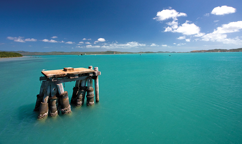
Cape York
Australias most Exciting ThrillingUnforgettable Destination
For thousands of years, Cape York has defied the onslaught of civilization. Until a little over 100 years ago, only Indigenous Australians enjoyed this unique paradise. History records the Europeans first touched our shores here almost four centuries ago but ironically this is still Australia’s last pioneering frontier, the last of our continent to be explored, settled or developed. Cape York Peninsula is also called the Tip and if you enjoy adventure, is well worth travelling through. There are plenty of places to stop along your journey through the Cape York Peninsula and several islands off of the far northern tip. Cape York has two seasons, the Dry Season and the Wet Season. The “Dry” Season is between May and October. The “Wet” Season is between November and April. The best time to visit the Cape is in the Dry Season, and although the drive is generally recommended for 4WD conventional vehicles can drive through the Cape as long as special care is taken and only in August and September. However, after rain the roads are generally impassable, so check road conditions before starting your journey.
Cape York Peninsula
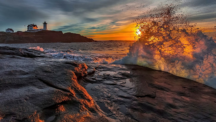
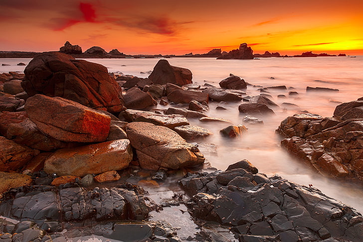
This vast remote region is one of great beauty, with a landscape of contrasts and surprises. It is a nature lover’s paradise with over 3000 plant species and 321 bird species inhabiting over 14 million hectares, and the rock art galleries of the Cape have been rated amongst the Top 10 most significant art sites in the world. Cape York is one of Australia’s last great wilderness areas and was voted number 13 on the list of “Things in Australia You Must Do Before You Die”.
Old Telegraph Track
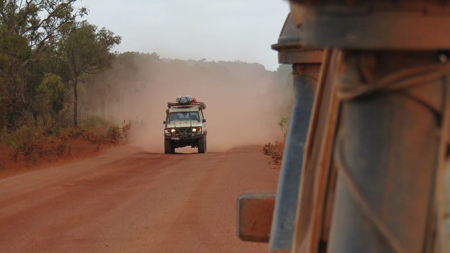
The OTT is a rough road and accessible only during the dry season. It passes through some beautiful country with several creek and river crossings, and there are several patches of deep sand. Bush camps are set up at most creek crossings. There are two bypass roads that allow travelers to get from the Peninsula Development Road to The Tip without having to navigate all of the creek crossings and rough roads. They pass mainly through the highlands to the east and west of the route, and are heavily corrugated which makes for a rough drive. Most visitors take the OTT track north and return via the Bypass roads, but the OTT is an integral part of this memorable journey providing adventure, tradition and stunning scenery.
Self-Drive Itinerary
Many travellers start their Tropical Far North Queensland and Cape York adventure from Cairns. Whichever way you choose to drive, the trip up Cape York will be an unforgettable adventure to mainland Australia’s northernmost point.
Cairns – Laura and Quinkan Country
Drive from Cairns through World Heritage-listed tropical rainforest out to Mareeba then join the sealed Mulligan highway north through rolling savannah to Quinkan Country and the 30,000-year-old rock art galleries at the Split Rock sandstone escarpment. Tours to other incredible rock art sites such as the Giant Horse and Mushroom Rock galleries can be booked through the Quinkan Regional and Cultural Centre. Other options include the rock art sites at Jowalbinna about 35 km from Laura. Camp either at Laura or in nearby Lakefield National Park, or alternatively split the journey at Lakeland where there is a caravan park where you can store your caravan. It is approx. 310 km from Cairns-Laura and approx. 330 km Cairns-Cooktown on the mulligan Highway route.
Laura-Lakefield – Musgrave Station
Explore Queensland’s second largest National Park Lakefield with its rivers, lagoons and swamps is a wildlife refuge and home to several threatened species. There is prolific birdlife, and both estuarine and saltwater crocodiles, with plenty of barramundi in the rivers. Recreational fishing is permitted at all camping areas with barramundi and catfish the most common species caught. Permits for camping can be obtained at Lakefield and New Laura self- registration shelters. 4WD is essential and campers need to be fully self- sufficient. There are several scenic campsites in the Park. From the Kalpower Crossing in Lakefield N.P. you can continue for a real adventure out to Cape Melville N.P. and great fishing spots at Bathurst Head. This is extremely remote so you will need to be fully self-sufficient. Drive on from Lakefield to Musgrave’s historic telegraph station. Alternatively you can continue on the Peninsula Development Road up to Musgrave, approx. 140km. Stop in at the Hann River Roadhouse for refreshments, 76 km past Laura.
Musgrave Station to Coen
The PDR continues for around 100km to the Cape outpost of Coen. There are campsites and basic accommodation in Coen as well as a post office, general store, mechanical services and petrol station. The beautifully restored Heritage House provides a glimpse back to the days gone by and a new exhibition of old mining equipment is on display next door to the Heritage House. An option on this stretch of road is to turn off towards Port Stewart and there are some lovely camping spots along the Stewart River.
Coen – Bramwell Junction
Visit the Cape York Information Center and Quarantine Inspection Station 20-km north of the township to find out more about this area. Friendly staff here can offer advice on places to visit road conditions. About 5km past the Quarantine Station is the turn off for Mungkan Kandju N.P. which is a noted bird watching area. There are several campsites in the Park and access in 4WD only. 66km further along the Peninsula Development Road from Coen, meals, camping and accommodation are available at Archer River Roadhouse as well as facilities for minor mechanical repairs. The PDR continues all the way up to Bramwell Junction but it is worth taking the turn offs to fully appreciate Cape York Peninsula. At the Wenlock River on the PDR, Moreton Telegraph station is a popular campsite.
Lockhart River and Portland Roads Route
About 35 km north of the Archer River is the turn off to Lockhart River, Portland Roads and Iron Range N.P. The first river crossing is at the Wenlock River and just past this there is a track which leads to the old Batavia goldfields where you can still see some of the old mining equipment. The next river crossing is at the Pascoe river – this is a longer stretch with a sandy bed. The track then leads towards Iron Range N.P. with some spectacular scenery and Australia’s largest area of lowland rainforest. The campsites at Chili Beach are very popular and there is great bird watching with 15 endemic species, and some interesting walking trails in the Park. Lockhart River is an Aboriginal community famous for the incredible array of artistic talent produced by the Lockhart River Art Gang. A visit to the Arts Centre is a great experience. There is also a supermarket and fuel in the town.
Portland Roads is a beautiful little fishing community with a couple of beach shacks for rent and a fantastic restaurant.
Weipa and Merluna Route
The turn off to Weipa is around 50km north of Archer River. The family operated Merluna cattle station is located off the Weipa road and also offers accommodation and camping. From Merluna you can drive tothe bauxite mining town of Weipa, with modern facilities and fantastic fishing. This is a good place to stock up on supplies or enjoy the world class fishing. From Weipa you can drive east through Batavia Downs Cattle Station to Moreton Telegraph Station, on the Wenlock River or continue from Merluna on the Telegraph Road up to Bramwell Station or Jardine National Park.
PDR Bypass Roads
From Bramwell Junction you can either take the challenging Old Telegraph Line 4WD route or the PDR Bypass roads which are maintained to a good standard. The Bypass roads are around 260 km from Bramwell Junction to the Jardine ferry which can take up to 5 hours. Interesting side trips from the Southern Bypass road include the turn off to Captain Billy Landing where there is a campsite. From the Northern Bypass road a popular turn off is to the beach at Vrilya Point on the West Coast – stunning sunsets, beach camping and great fishing are the major drawcards.
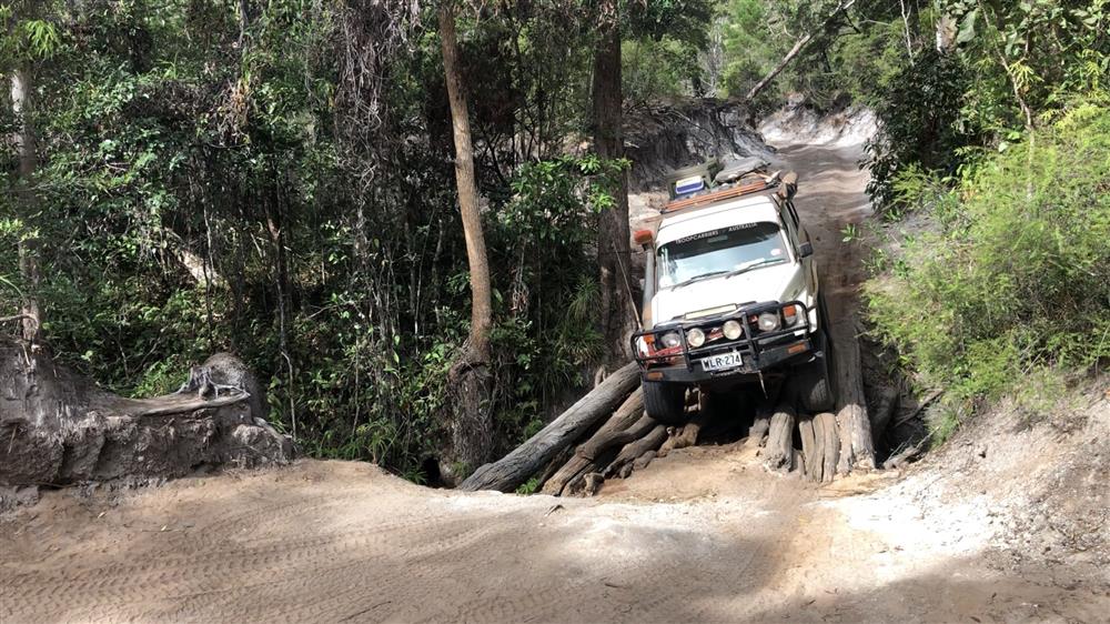
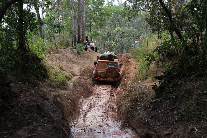
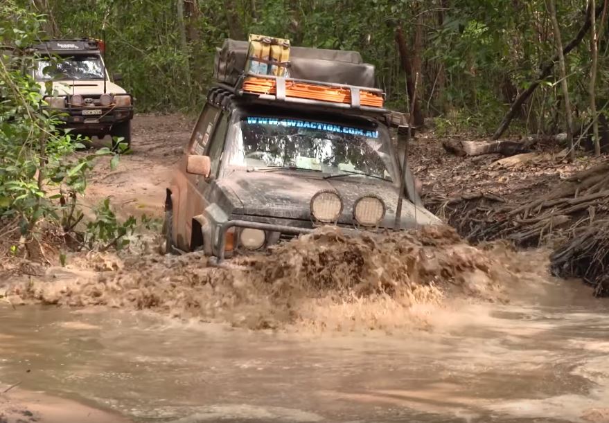
The Old Telegraph Line
The Old Telegraph Line really starts after Bramwell Junction and continues up to the Jardine River. It is important to have a properly equipped 4WD for this adventurous route but most travellers to the Cape will take the OTL north then return by the Bypass roads. Driving north you will need to negotiate several creek crossings, some of which have challenging entry and exit points. Palm Creek is the first crossing, then you face the Ducie River, South Alice Creek and North Alice Creek. After around 30 km from Bramwell Junction you come to the Dulhunty river which is a popular spot to camp. Next is Bertie Creek and after this there is the option of the Gunshott bypass or continue on the OTL to Cholmondely Creek. The infamous Gunshott Creek is the next crossing – this is probably the most challenging crossing on the OTL. Then you continue to Cockatoo Creek, another challenging crossing, and the final creek crossing is the bridge over Sailor Creek. The section from Bramwell Junction to the intersection with the Northern Bypass Road is approx. 80 km which can take up to 5 hours depending on conditions. At this junction there is a track to Heathlands Reserve and the lovely Fruit Bat Falls which offers a refreshing swim stop on the way to the campground at Eliot Falls and Twin Falls. The OTL continues from Eliot Falls through the rough Canal Creek, and then you face crossings at Sam Creek, Mistake Creek, the aptly named Cannibal Creek, the rickety old bridge over Cypress Creek, Logan Creek and Nolan’s Brook before emerging at the Jardine River. Tracks then leads back to the Northern By pass road and the Jardine River ferry. The section from Eliot Falls to the Jardine River is approx. 40 km and can take up to 4 hours depending on conditions.
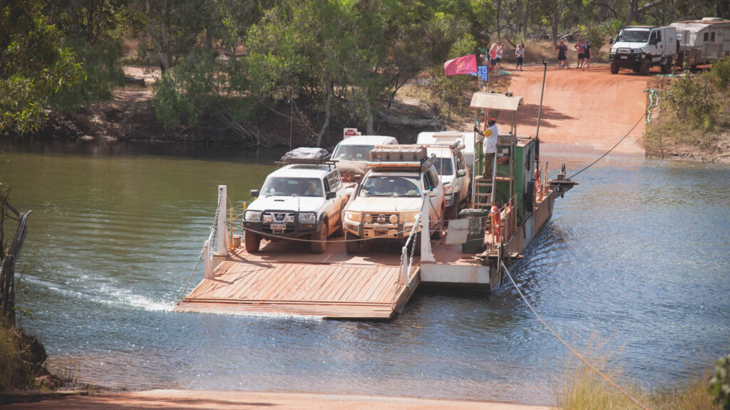
Jardine River – Bamaga / Seisia /Tip of Cape York
Cross the Jardine River by cable ferry and head to the northernmost Tip of Australia. The ferry costs $88 return for cars, $100 with a trailer and $35 for motorbikes and the permit must be shown if camping at Vrilya Point and all bush camps north of the Dulhunty River. The ferry operates from 08.00-17.00 daily in the dry season. Please contact NPARC on 07 4069 1369 for further info. The drive from the Jardine ferry to Bamaga is about 42 km and Seisia is 6km north of Bamaga. There are several camping and accommodation options in Bamaga, Seisia, Loyalty Beach and Punsand Bay with guided tours, hire cars and fishing available within the area. As well as the great fishing there are several WW2 sites, pioneer mining sites and old telegraph memorabilia to visit. Long stretches of deserted beach and the Lockerbie Scrub rainforest Trail provide good walking options. The historic Somerset beach is another popular site to visit. The Tip of mainland Australia is 32km from Bamaga and 7km north of Lockerbie – the must see destination for all visitors to Cape York Peninsula. Having made it to The Tip spend a few days to enjoy the whole area and why not extend your trip to the Torres Straight Islands. Thursday Island is just 30 km from Cape York Peninsula and easily accessible by ferry from Seisia.
4WD Travel, Adventure and Camping
The wide open wilderness areas and warm climate of the Cape York regions make them ideal destinations for caravan and 4WD Camping Holidays. The main season is between May and October, so you need to book in advance to avoid disappointment. Start planning your holiday with Cape York 4WD Hire from Cairns to Cape York or south via Pacific Coast Touring Route or do the Savannah Way to Darwin or even Broome.
Campabout Oz Camper Hire
Campabout Oz 4WD Hire has a national wide network of agencies which are strategically positioned in close proximity to all famous tourism destination and hot spots, as well as major regional and capital cities throughout Australia so you are never far from a pick up point or friendly service to make your Road trip a memorable one.
Campabout Oz 4WD Hire is renowned for meticulously maintained vehicles and quality service. Our fleet is constantly being updated to ensure you enjoy the best in comfort and safety making it the ideal choice for your next self-drive adventure. 4WD Tourism is one of the best ways to see the sights of Australia and it offers you the freedom & flexibility to discover the outdoors at your own pace. For your Gibb River Road 4WD Hire adventure please contact us on + 61 8 9858 9126 or email us on info@campaboutoz.com.au or visit us at www.campaboutoz.com.au